A very sluggish weather pattern is in place right now with no real change in the pattern expected through this weekend.
A broad upper level trough will remain over the upper Midwest through Sunday, but the amount of lift/forcing with this trough isn’t very strong, and is also fairly disorganized, so what we’re left with is for areas of rain in the Northland, while other areas get very little rain at all. Winds aloft are very weak, however, and that combined with a juicy air mass overhead could produce pockets of heavy rainfall, but it’s nearly impossible to predict what areas of the Northland would be impacted by these pockets of heavy rainfall since they will likely be pretty isolated.
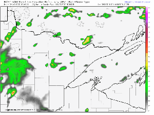
MRMS radar loop ending 5:50 PM Friday, October 1, 2021.

So far the most significant rains have been confined to western portions of the Northland with little to no rain so far for the North Shore, Twin Ports, eastern Minnesota and northwest Wisconsin.

24 Hour Rainfall Reports ending 4 PM Friday, October 1, 2021
Longville, MN: 1.05″
Cass Lake, MN: 0.56″
Grand Rapids, MN: 0.47″
Brainerd, MN: 0.42″
Hill City, MN: 0.38″
Chisholm-Hibbing Airport: 0.35″
Pine River, MN: 0.35″
Orr, MN: 0.33″
Walker, MN: 0.31″
Bigfork-Effie, MN: 0.30″
Eveleth-Virginia, MN: 0.30″
Ely, MN: 0.22″
International Falls, MN: 0.19″
Crane Lake, MN: 0.09″
Littlefork, MN: 0.08″
McGregor, MN: 0.06″
Seagull Lake, MN: 0.05″
Isabella, MN: 0.01″
Duluth Airport: Trace
Lots of juice in the air today with dewpoints across the Northland in the low to mid 60s on this 1st day of October 2021.

PWATS or Precipitable Water is also on the high side especially for this time of year, with values approaching 1.50″ in parts of the Northland late this afternoon. What this means is where it does rain, it could be heavy at times due to all the moisture in the atmosphere.

Goes-16 water vapor loop from Friday, October 1, 2021.

18z NAM 3km model simulated radar forecast valid through 7 PM Sunday.
Expect quite a bit of cloud cover this weekend, along with some rain/drizzle at times, but there should also be dry hours mixed in, similar to what we saw today (Friday).

Rainfall totals ranging from one tenth of an inch to three quarters of an inch are possible in northeast Minnesota and northwest Wisconsin thru Sunday.

Note: Record Warm Low Temperatures have occurred at International Falls, Minnesota the last few days.
September 29: Record Warm Low Temperature of 52 degrees was tied at International Falls on Thursday. This record was set in 1980 and 1995.
September 30: A new record warm low temperature was set at International Falls on Friday with a low of 57 degrees. The previous record warm low was 54 degrees set in 1897, 1920 and 2013.
High temps remain on the mild side in the Northland thru next week, with highs in the 60s to around 70 Saturday and Sunday, and in the mid 60s to low 70s Monday thru Thursday.

Tim
Leave a Reply