5:31 PM Thursday, January 27, 2022
At least this latest round of arctic air will be short lived as it peaks tonight before temperatures begin to moderate, with 20s for daytime highs looking likely for Saturday and Sunday, and by next Monday and Tuesday we may see temperatures as warm as 30-32 degrees in parts of the Northland. Note: Normal highs at this time of year are generally in the mid-teens to low 20s in our area.
The clipper parade is set to return this weekend into early next week, but no real impacts are expected from these clippers besides shifting winds ahead of and behind these low-pressure systems.
The first clipper moves across the area Saturday and may bring a little snow to the tip of the Minnesota Arrowhead, but the remainder of the Northland should be dry on Saturday.
An additional clipper or two may affect the area early next week and those ones may bring minor snow amounts to some parts of the Northland depending on the track they take, but I’m not seeing any strong model signals for a major snow event impacting our area at least through late next week (February 4)
Back to the subzero stuff tonight with lows in the teens and 20s below zero in northeast Minnesota and northwest Wisconsin.

WIND CHILL ADVISORY in effect from Midnight tonight to 8 AM Friday including portions of northeast, north-central and east-central Minnesota and the cities of International Falls, Bigfork, Grand Rapids, Walker, Hill City, Moose Lake, Cloquet, Duluth, Hibbing, Virginia, Cook, Crane Lake, Orr, Ely, Two Harbors, Isabella, Silver Bay and Grand Marais. IMPACTS — Wind chills as low as 25 below to 30 below zero.

Here’s a look at the average number of hours with a wind chill of 20 below zero or lower.
All of northeast Minnesota and northwest Wisconsin typically has anywhere from 168 hours to as much as 600 hours during any month with a wind chill of 20 below zero or lower.

It was all about the big-time warmup on Wednesday, but now we’re seeing a return to much colder temperatures today.

We are looking at a pretty nice warmup and a nice break from the arctic air for this weekend into early next week.
Here’s the high temperature forecast valid for Saturday, January 29, 2022, through Tuesday, February 1, 2022.

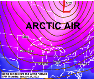
Chances for another blast of arctic air are on the rise for mid to late next week, but there are a few things to keep an eye on which may change things a bit.
-One of those things would be a possible area of low-pressure lifting NE out of the Southern Plains mid to late next week. At the moment it looks like that low would pass well to our SE as it makes its way through the Ohio Valley, but if this low tracks farther west, that may help keep the coldest air back over the Dakotas instead of it spilling farther east into the upper Midwest.
-Another thing to watch would be where the arctic highs setup mid to late next week, and the position of those highs may hinge on how that aforementioned low tracks later next week.
-This round of arctic air for later next week may be the coldest air mass we’ve seen this winter, and we’ve had plenty of cold shots this winter. There is a chance that high temperatures remain well below zero in the Northland between February 3-5 with overnight lows possibly as cold as -40 F in the typical cold spots across northern Minnesota.

Thanks for reading!
Tim
Leave a Reply