4:43 PM Monday, February 28, 2022
Well, we made it through another winter, and I’d rank the winter of 2021-22 right up there with the winter of 2013-14 and a few epic winters we had back in the 90s. Of course, we’re not done with the snow and cold just yet, I mean this is the Northland, and we can easily get snow well into April and even into May, but winter can’t hang on forever. Days continue to get longer, and the sun angle is getting stronger! We’re almost there…
A storm system may impact the upper Midwest including for us in the Northland this weekend, but there are differences on the storm track, and on how much precipitation we see in our area this weekend.
Basically, seeing two camps when it comes to the storm track this weekend.
One camp is farther northwest with the storm track, the other camp is farther southeast.
A farther northwest track to the low would likely bring in enough warm air aloft leading to a higher risk for getting some freezing rain/sleet (ice accumulations) in parts of the Northland this weekend.

Here’s a look at the EPS model storm track for this weekend.
Mean low pressure center (red L) while individual member centers show up as numbers on the animation below.
Forecast from 6 AM Saturday, March 5, 2022, to 6 AM Sunday, March 6, 2022.

Probabilities for getting more than 3 inches of snow are rather high in the Northland this weekend, with the greatest chances extending from east-central to northeast Minnesota into northwest Wisconsin.

Another component to this weekend’s system is the potential for freezing rain and sleet with a chance for significant ice accumulations of 0.10-0.25″+ extending from the southern half of Minnesota into parts of central and southern Wisconsin. Lesser amounts of ice are currently expected in the Northland this weekend, but there is still a possibility for some freezing rain and or sleet, especially over southern portions of the Northland. And there is also a possibility that will see the area of greatest ice accumulations shift a little farther north in later forecasts.

A big-time temperature contrast in place today.
3 PM temperatures ranged from 69 at Omaha, Nebraska to 26 at Duluth, Minnesota.

Temperatures were running 20 to over 30 degrees above average in parts of South Dakota, southwest Minnesota, Nebraska and Iowa this afternoon.

Highs Tuesday look pretty similar to what we saw on Monday with readings in the mid 20s to low 30s across the Northland, while it’ll be much warmer farther south, with 50s to near 60-degree temps in far southwest Minnesota, with temperatures well into the 60s in southern parts of South Dakota.

3 clipper systems through Wednesday.
-The first lingers into this evening with a little snow in far northern Minnesota and over the Arrowhead (north of Duluth)
-A second clipper scoots SE bringing a brief period of snow to central Minnesota Tuesday morning, but this system with its precipitation looks like it will pass south of the Northland.
-A third clipper may bring some snow farther north into much of the Northland Wednesday morning.
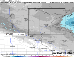
Radar forecast ending 12 PM Wednesday (snow in blue colors)

Thanks for reading!
Tim
Leave a Reply