6:22 PM Sunday, March 6, 2022
The pattern this week will be quite active, but the weather in the Northland looks pretty quiet as the main storm track sets up farther to the south/east this week.
Storm which affected parts of the Northland Saturday into Sunday morning continues to move ENE as it heads across eastern Canada today while the next system ejects ENE out of the Southern and Central Rockies today.
Goes-16 water vapor loop from Sunday, March 6, 2022

No signs of any major warm up or a prolonged thaw coming to the Northland this week into at least early next week.
Looks like we may get close to the freezing mark in Duluth on Tuesday, and possibly again early next week but that’s it.
For comparison, the normal highs in the Northland in early March are in the low to mid 30s, so overall we’re looking at below normal temperatures at least through March 16.

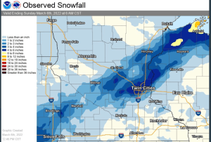
Snowfall Reports for the March 4-6, 2022, Winter Storm
Washburn, WI: 7.5″
3 S Cornucopia, WI: 7.0″
9 N Bayfield, WI: 6.0″
Red Cliff, WI: 5.5″
5 W Bayfield, WI: 5.0″
3 ESE Sarona, WI: 5.0″
1 W Solon Springs, WI: 5.0″
0.5 WNW Ashland, WI: 4.6″
2 N Hawthorne, WI: 4.0″
0.1 NE Hovland, MN: 3.5″
2 E Poplar, WI: 3.5″
0.6 SW Grantsburg, WI: 3.2″
Mason, WI: 2.8″
4 SE Danbury, WI: 2.5″
Gile, WI: 2.5″
6 SW Finlayson, MN: 2.5″
Minong, WI: 2.3″
3 NE Duluth, MN: 1.5″
3 ENE Grand Marais, MN: 1.5″
5 S Herbster, WI: 1.5″
9.7 SSE Wrenshall, MN: 1.3″
Port Wing, WI: 1.3″
3 ENE Holyoke, MN: 1.3″
3.7 WNW Superior, WI: 0.6″
French River, MN: 0.5″
3 W Duluth, MN: 0.5″
Silver Bay, MN: 0.5″
Freezing Rain Reports for the March 4-6, 2022, Winter Storm
Ashland, WI: 0.44″
Hayward, WI: 0.41″
Mellen, WI: 0.38″
Mason, WI: 0.30″
1 E Spooner, WI: 0.30″
4 SSE Webster, WI: 0.25″
Cable, WI: 0.20″
Duluth, MN (Airport) 0.17″
4 SE Danbury, WI: 0.13″
Minong, WI: 0.10″
1 W Silver Bay, MN: 0.10″
The next storm for tonight and Monday will be passing well to the south of the Northland with no impacts for us.
This storm will bring some severe weather including a risk for tornadoes to the Ark-La-Tex and Ozarks to the Ohio Valley and Tennessee Valley tonight, with some snow occurring in the colder air from parts of Kansas and Missouri into parts of Iowa, Illinois and Wisconsin through Monday.


There is a chance for another storm to develop later this week over the Southern Rockies into the Southern Plains, but at the moment it looks like the cold air will win out which should help keep this potential late week system well SE of the Northland.

Thanks for reading!
Tim
Leave a Reply