5:32 PM Friday, May 6, 2022
Soak up the sun on Saturday because Sunday is looking quite a bit cloudier compared to the last few days, and we’re also looking at a chance for some rain showers on Sunday.
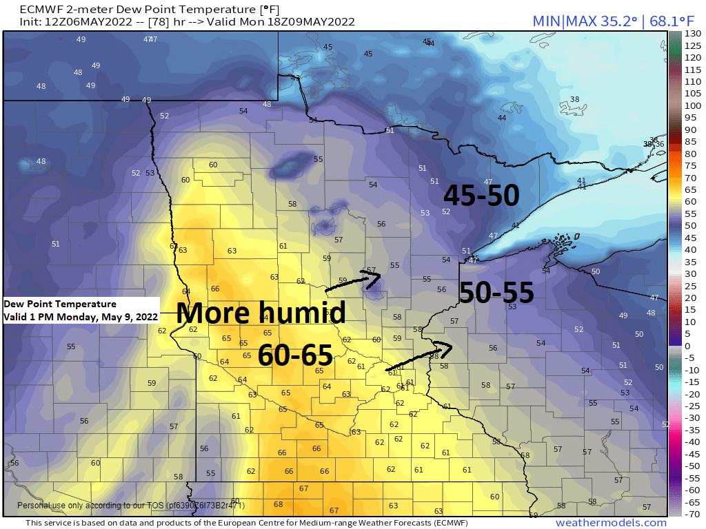
Next week continues to look mild with a muggy feel on a few days and there are also chances for some showers and thunderstorms at times throughout next week.
On May 6th, 2016, Duluth recorded its earliest 90-degree temperature ever with a high of 92 degrees (weather records for Duluth date back to 1874). The previous earliest 1st 90 in Duluth occurred on May 14th (1932).

Another fantastic spring day in the Northland with highs today topping out in the mid 60s to lower 70s but it was a lot cooler (40s) within about 15-20 miles of Lake Superior due to a breezy NE wind today.
Today, Friday, May 6th marked the 2nd consecutive day with a high of at least 60 degrees at the Duluth Airport. Summer’s coming!

Mid and upper-level pattern is undergoing some big-time changes and we’re seeing hints of this change in today’s 500mb pattern which features a strong mid/upper-level system over the Ohio Valley with ridging to the north across central Canada while another upper-level system approaches the Pacific northwest late today.

Water vapor loop from Friday, May 6, 2022.

There continues to be a risk for a few severe thunderstorms on Monday in parts of the upper Midwest including southern parts of the Northland east of a line from Hinckley to Pine City including much of northwest Wisconsin. The risk for severe weather has shifted back to the south compared to 24 hours ago and expect some more changes to this forecast over the next few days.
There is considerable uncertainty on how things setup on Monday due to the possibility for morning rain showers and isolated thunderstorms. The precipitation Monday morning could affect temperatures, moisture return and the amount of instability that develops later in the day, but if sufficient clearing and heating and moisture advection occurs Monday afternoon, then we could see a few strong to severe thunderstorms develop late Monday afternoon or Monday evening mainly from eastern Minnesota into much of western and central Wisconsin.

A wetter pattern is expected next week with above average precipitation for the northern Plains into parts of the upper Midwest, while below average precipitation is forecast farther to the south and east since those areas will be near a strong upper-level ridge for much of next week.

Rainfall totals of an inch or more are possible over western parts of the Northland through next Saturday with lesser amounts of rain farther east.
Rain won’t be continuous next week but there are chances for rain on Sunday and Monday, and again from Wednesday through Saturday.
The pattern next week is more summer like meaning that this rain will probably be scattered in coverage with some areas getting lots of rain, other areas not as much rain.

A massive upper-level ridge covering the Midwest will lead to hot temperatures and a chance for record breaking warmth (circled areas on animation below) next week, with Tuesday through Thursday currently looking like the warmest days next week.
Temperatures won’t be as warm in the Northland next week, but we’re still looking at daytime highs in the 60s and 70s in our area which is above average for this time of year, and there is a chance for even warmer temperatures (near 80 or into the 80s) on 1 or 2 days later next week.

Thanks for reading!
Tim
Leave a Reply