5:12 PM Wednesday, August 10, 2022
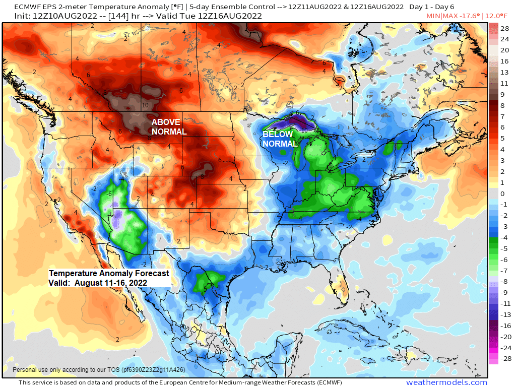
A cooling trend is on the way to the Northland over the next few days with the coolest temperatures likely on Friday, this is when we could see daytime highs only in the 50s and 60s in much of northeast Minnesota and northwest Wisconsin while temperatures in the 90s to near 100 degrees are possible in southwestern Minnesota Friday afternoon.
Highs in the 70s are likely in the Northland on Thursday, with 60s near Lake Superior. More 60s and 70s are expected for daytime highs in our area for Saturday and Sunday, with the warmest temperatures found inland from Lake Superior.

The average water temperature of Lake Superior continues to run well below normal for this time of the year.
August 10, 2022: Lower 50s
Normal on August 10: Lower 60s
On average, the water temperature of Lake Superior is at its warmest over the next few weeks.

A low-pressure system moving out of South Dakota on Friday could bring some rain to parts of the Northland on Friday, but computer models differ on how far north this rain will get, however, the most likely area for some rain stretches from central Minnesota into western Wisconsin, but this could shift a little farther north over the next 24 hours.
NWS Blend of Models rainfall forecast through late Friday night.

NAM 3km model simulated radar forecast valid from Midnight Friday to Midnight Saturday.

Here’s the 500mb forecast through next Wednesday, August 17, 2022.
Nothing but northwest flow aloft for the upper Midwest over the next 7 days, this will help keep the most persistent heat locked up farther to the southwest, basically where it’s been most of the summer.

Thanks for reading!
Tim
Leave a Reply