5:47 PM Friday, August 26, 2022
Scattered showers and thunderstorms are likely in the Northland Overnight tonight into Saturday morning as a strong low-level jet causes a warm air and moisture advection pattern to setup over the upper Midwest. Will also see an increase in elevated CAPE Saturday morning which will lead to a few thunderstorms embedded in the area/s of rain, but severe weather is not expected with this activity, but heavy downpours are a possibility.
For Duluth — Some rain is possible at times from around 4 AM to 9 AM Saturday, with some redevelopment possible later Saturday afternoon/evening from around 6 PM to Midnight.
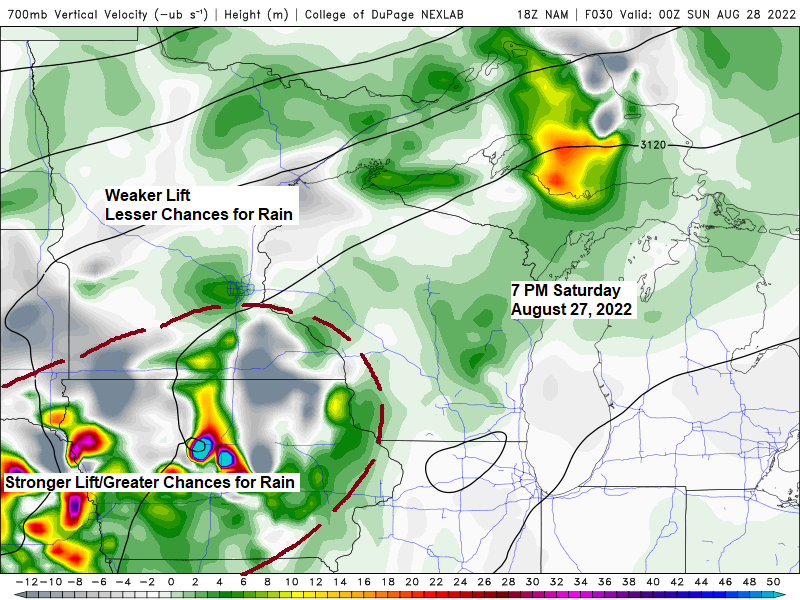
The disturbance which will bring some rain to the Northland later tonight is showing up very nicely on visible satellite imagery this afternoon as it moves ENE across the eastern Dakotas. Once this disturbance passes through the area Saturday morning there isn’t really a whole lot of forcing to work with to get some more rain to develop in the Northland for Saturday afternoon through most of the day Sunday. A cold front will then move across the area Sunday night with better forcing leading to an increase chance for some showers or thunderstorms affecting parts of the Northland.
Goes-16 visible satellite loop from Friday afternoon, August 26, 2022.

The strongest signal for rain in the Northland this weekend per model guidance occurs Saturday morning, after that there are mixed signals showing up in the computer models as to whether or not will see another round of showers and thunderstorms develop late Saturday afternoon or Saturday evening, but the trend through the day has been for less and less rain in most of the Northland for Saturday afternoon/evening.
Rainfall amounts ranging from around 0.10″ to 0.50″ are possible in the Northland through Sunday morning, with locally higher amounts of greater than 0.50″ possible over parts of north central and east central Minnesota.

NAM model is a bit more aggressive showing the development of another area of showers and thunderstorms late Saturday afternoon/evening in northeast Minnesota generally along and north of Highway 2.
NAM 3km model radar forecast from Midnight tonight to Midnight tomorrow night.

HRRR model doesn’t show a whole lot of rain redeveloping in the Northland after Saturday morning’s rain exits the area.
HRRR model radar forecast valid Midnight tonight to Midnight tomorrow night.

There’s been some changes in the forecast for next week as it looks like the upper Midwest will be dominated more by a trough which will be centered over the Great Lakes for the early-middle portion of next week, while a ridge sets up a little farther west compared to what it looked like 24 hours.
There are signs showing up per model guidance for that western ridge to move a little farther east next weekend which could lead to warmer temperatures in the Northland during the Labor Day weekend, but before then it looks like temperatures will be running a bit below normal in northeast Minnesota and northwest Wisconsin for much of next week.
High temperatures will mainly be in the 70s to lower 80s in northeast Minnesota and northwest Wisconsin for Saturday and Sunday followed by highs in the 60s and 70s from next Monday through Thursday.
Next week continues to look mostly dry in the Northland with the only threat for a few showers occurring on Monday.

Thanks for reading!
Tim
Leave a Reply