5:36 PM Friday, October 7, 2022
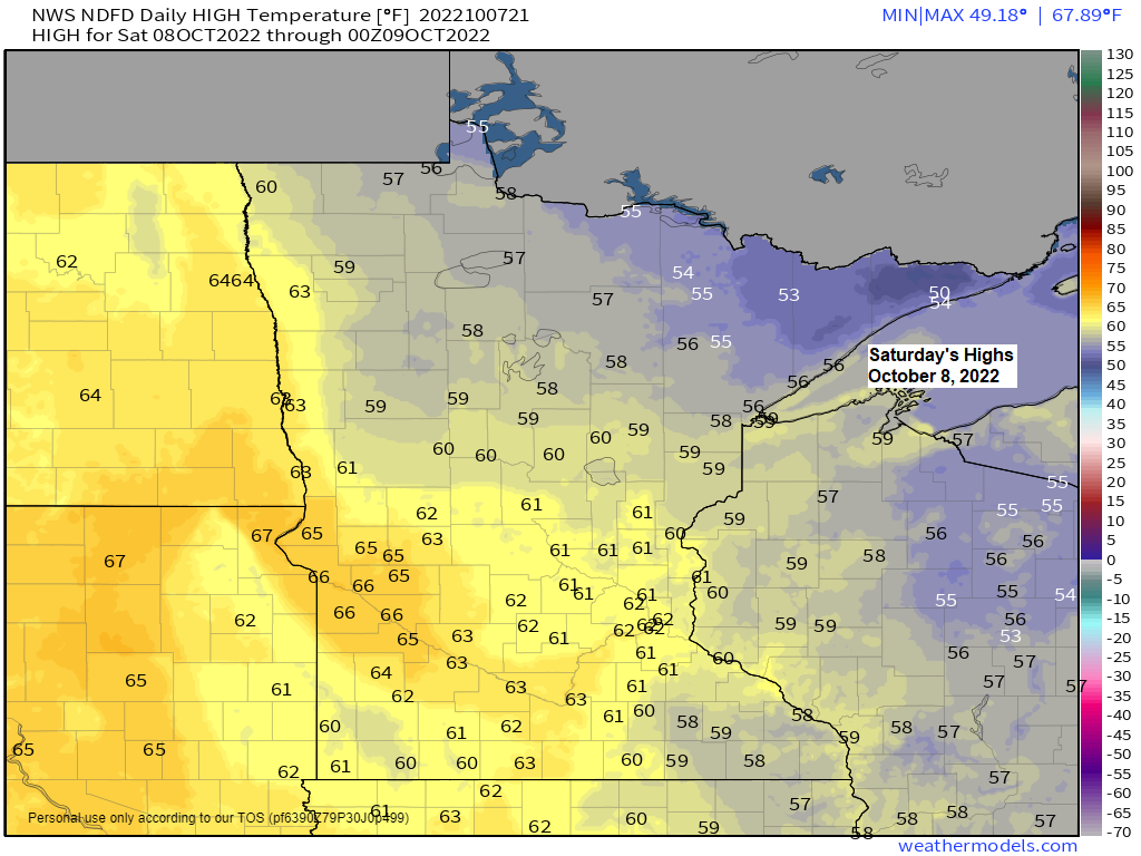
A very cool early October day in the Northland with temperatures only in the 40s today, but warmer weather will return this weekend into early next week, with temperatures climbing back into the 50s to around 60 this weekend, and into the 60s and possibly even into the lower 70s next Monday and Tuesday, but big changes are brewing again for later next week which could include some accumulating snow in parts of the Northland!
About the only real weather issue this weekend will be a cold front which moves south across the area Saturday night, no rain or snow with this front, but east winds will develop near Lake Superior behind this front for Sunday with cooler temperatures likely near Lake Superior.

Temperatures are running about -10 to -15 degrees colder than normal today across the upper Midwest.

One thing that helped to bring the cool temperatures to the Northland today is this very strong mid-upper level low over James Bay Canada today — Winds aloft are out of the NW behind this system.
Goes-16 water vapor loop (ending 5:10 PM Friday, October 7, 2022)

An amplified weather pattern looks to setup later next week with strong ridging well to the east and west while a trough deepens across central Canada while digging south into the Great Lakes and Midwest — This is a cold pattern for the Northland as waves of cold air push south out of far northern Canada later next week.

Below normal temperatures are forecast across the Northland for October 12-17, 2022.

A strong trough averaging -1 to -2 sigma per European model guidance is forecast to move east out of the Rockies and Northern Plains mid to late next week.
A few of the computer models (Euro and German-Icon) are very aggressive in showing a strong low-pressure system developing across the Great Lakes later next week with a chance for some snow or rain — This will be something to watch for the October 13-14 time frame.

Here’s the 500mb forecast per 12z ICON model valid 7 PM Wednesday through 7 AM Friday, October 12-14, 2022.
That is one strong system per ICON guidance as this model shows some phasing occurring between some northern energy and southern energy later next week.

At least a little snow is possible over parts of the Northland late next week. Will see if these totals trend higher or if they disappear in coming days.

Thanks for reading!
Tim
Leave a Reply