5:12 PM Friday, November 11, 2022
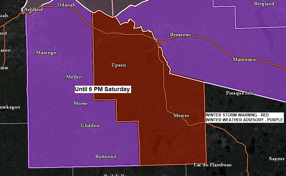
Lake effect snow is likely through Saturday night along the South Shore of Lake Superior in northwest Wisconsin with scattered flurries and snow showers possible elsewhere in the Northland, but the most significant snow amounts tonight and Saturday will certainly be downwind of Lake Superior in northern Wisconsin.
Snowfall forecast thru 6 AM Sunday.

18z NAM 3km model radar forecast through 6 AM Sunday.
Snow in blue

The pattern for next week will feature broad upper level troughing across the Plains, upper Midwest and Great Lakes (blue and green colors on animation below)

On the surface, not much to speak of in terms of strong low-pressure systems for next week, but a broad surface trough is forecast to setup across the upper Midwest with some weak lift which should be enough to squeeze out some snow at times for the early to mid-part of next week.

One thing which could boost snow amounts next week will be Lake Superior. Low-level winds are expected to become easterly from Monday through early Wednesday, and with a cold air mass in place we could be setting the stage for some lake enhanced/lake effect snowfall along the North Shore of Lake Superior, to possibly as far south as Duluth depending on the wind direction.

The Northland will be in a colder than average pattern at least for the next 7-10 days with some of the coldest air possibly arriving for next weekend with a chance for low temperatures near zero or even below zero in parts of the Northland.

Warmer trends are showing up in computer models for Thanksgiving week.

A strong fall storm brought widespread rain, snow, sleet, freezing rain, strong winds and even a few thunderstorms to the Northland over the last few days. Snowfall storm totals did end up quite a bit lower than what was forecast in far northern Minnesota due to precipitation staying as a wintry mix much longer than expected, this led to snowfall storm totals being less than what was forecast, but elsewhere in the Northland snow totals went pretty much as expected.
The big snowfall winners with this winter storm went to central North Dakota with a foot or more of wind driven snow.

| Snowfall Reports from November 10-11, 2022 Source: NWS Duluth, MN International Falls, MN: 3.0″ Cook, MN: 2.0″ 1 ESE Babbitt, MN: 2.0″ 3 SE Finland, MN: 1.7″ 1 W Buyck, MN: 1.5″ 4 ENE Tofte, MN: 1.5″ Cotton, MN: 1.0″ Days High Landing, MN: 1.0″ Coleraine, MN: 1.0″ Talmoon, MN: 1.0″ Embarrass, MN: 1.0″ 1 E Taft, MN: 0.6″ 9 NNW Bovey, MN: 0.5″ 4 W Grand Marais, MN: 0.5″ Duluth, MN (NWS) 0.4″ 2 WSW Lester Park, MN: 0.1″ Ice Accumulation Reports from November 10-11, 2022 Source: NWS Duluth, MN 1 W Buyck, MN: 0.20″ Crane Lake, MN: 0.20″ (also 1″ of sleet accumulation) 1 NW Chisholm, MN: 0.10″ Ely, MN: 0.10″ |
3-Day Precipitation Reports (November 8-10, 2022)
Ashland, WI: 2.80″
Duluth, MN: 2.67″
Hibbing, MN: 1.66″
Brainerd, MN: 1.60″
International Falls, MN: 0.57″

Thanks for reading!
Tim
Leave a Reply