4:44 PM Sunday, December 4, 2022
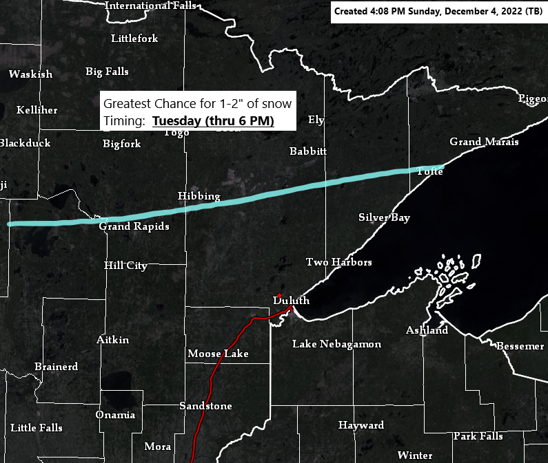
- No big storms to affect the Northland this week, but a few weaker systems will bring at least a little bit of snow to the area, with a few snow showers and flurries on Monday, followed by a greater chance for some snow on Tuesday, and possibly again on Wednesday, and possibly again for next weekend (Dec. 10-11)
- There is a larger system showing up in model guidance for later this week, but the current track of this system would keep the measurable snow well to the south of the Northland Thursday into early Friday.
- Another shot of arctic air could affect the Northland midweek, but the bulk of the most severe cold will remain farther to the northwest of our area this week.
Milder temperatures returned to the Northland today with highs in the 20s to lower 30s, but temperatures were even warmer in southwest Minnesota with temperatures in the 40s this afternoon.

Temperatures across the area this afternoon were running +15 to +25 degrees warmer than 24 hours ago.

Blustery southwest winds of 15 to 25 mph with gusts to 35 mph are expected in the Northland this evening.
HRRR model wind gust forecast thru Midnight tonight.

A few brief shots of arctic air are likely in the Northland this week but looking ahead to next week shows the temperatures trending warmer in model guidance.
EPS model

GEFS model temperature anomaly trend for December 11-16, 2022.
Blues – Below average temperatures
Orange and Red – Above average temperatures

Thanks for reading!
Tim
Leave a Reply