5:18 PM Friday, December 2, 2022
- Snow tonight especially before Midnight with accumulations ranging from a dusting to 3 inches, highest snow amounts in parts of northern Minnesota, and also along the South Shore of Lake Superior in northwest Wisconsin.
- Rapidly falling temperatures this evening with strong NW winds developing.
- Flash freeze possible this evening in parts of eastern Minnesota and northwest Wisconsin.
- Highs only in the upper single digits and 10s Saturday.
A variety of weather headlines in effect for much of the Northland tonight through early Saturday morning.
- Winter Weather Advisory for northern Minnesota, Arrowhead and North Shore, and also for the South Shore in northwest Wisconsin. Some cities in the winter weather advisory include International Falls, Bigfork, Grand Rapids, Cass Lake, Walker, Hibbing, Virginia, Ely, Cook, Orr, Isabella, Two Harbors, Silver Bay, Lutsen, Grand Marais, Poplar, Brule, Port Wing, Washburn, Bayfield, Ashland, Butternut, Hurley and Gile.
- Wind Advisory in effect from 10 PM this evening to 8 AM Saturday for parts of northeast Minnesota including Duluth, Two Harbors, Silver Bay and Grand Marais.

Snow across the Northland this evening with a brief mix of precipitation possible early this evening in northwest Wisconsin and eastern Minnesota.
Snow ends from W-E by late tonight, but some lake effect snow showers are likely along the South Shore of Lake Superior overnight.
For Duluth – Some snow this evening, ending between 9 PM and 11 PM.
12z NAM 3km model radar forecast thru 6 AM Saturday
Snow in blue

Snowfall accumulations of 1 to 3 inches are possible tonight in northern Minnesota, and also along the South Shore of Lake Superior in northwest Wisconsin.
Note – Up to 1″ of snow is possible in Duluth this evening.

Windy tonight into Saturday morning
Northwest winds will increase to 15 to 25 mph across the Northland this evening with wind gusts as high as 40 to 50 mph. The strongest winds will occur tonight through early Saturday morning. Winds diminish Saturday afternoon with gusts to 25 mph.
HRRR model wind gust forecast thru 6 PM Saturday.

Very Cold Wind Chills Tonight and Saturday
The combination of gusty winds and much colder temperatures will cause wind chill temperatures to fall into the single digits below to around 20 below zero in the Northland tonight through the day Saturday.
HRRR model wind chill forecast thru 6 PM Saturday.

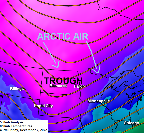
Big-time temperature contrasts today
Temperature contrast in Minnesota at 3 PM today ranged from 3 degrees at Hallock, to 45 degrees at Winona.

An even more extreme temperature contrast today between Gillam, Manitoba -15 F, to 76 F at Hays, Kansas.

Dust Storm
Strong winds gusting 50 to nearly 70 mph are kicking up the dust in northwest Kansas this afternoon, and this dust storm was clearly visible on Goes-16 satellite imagery this afternoon.

Animation of the southeastward moving dust storm in northwest Kansas this afternoon.
Goes-16 visible satellite loop from Friday, December 2, 2022.

Temperature trends for next week
We’re still looking at below average temperatures in the Northland next week, although the coldest temperatures look to stay farther NW of our area.
Note – We’re also looking at a few more snow chances next week, although no major storms or significant snow events are expected at this time.

GEFS model temperature anomaly trend for December 4-9, 2022
Note how the temperature anomalies are trending warmer (orange/red colors) across the southern/eastern U.S for next week.
Blue and purple colors represent below average temperatures.

Thanks for reading!
Tim
Leave a Reply