10:20 AM Sunday, December 11, 2022
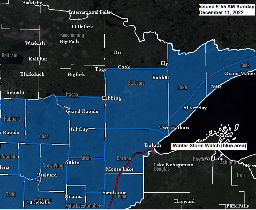
Winter Storm Watch has been issued for parts of the Northland ahead of a midweek storm which looks to bring a significant amount of wintry precipitation to much of the Northland.
Timing of this precipitation looks to be from Tuesday evening through Wednesday, but additional precipitation is possible for Thursday and maybe even into Friday depending on how this system evolves.
Heaviest precipitation rates are expected from late Tuesday night through Wednesday.
A dry slot could affect much of the Northland as it spreads from south to north late Wednesday-Wednesday night, and if this dry slot moves over us, then precipitation will shut off or taper off to drizzle/freezing drizzle for several hours on Wednesday.
Precipitation types remain in question due to the amount of warm air which will be in place ahead of this system, with temperatures hovering around the freezing mark, to as warm as 34 to 35 degrees especially over northwest Wisconsin.
This will be a slow-moving system that is a certainty given how blocked up the pattern will be this week, and because of this, it will take time for the precipitation to get into the Northland.
Currently it looks like the precipitation (snow or wintry mix) will move into southern areas (south of Duluth) late Tuesday afternoon/evening after 5 PM with snow or a wintry mix eventually spreading farther to the north through Wednesday morning.
Note – Snow or wintry mix begins in Duluth early Wednesday morning (between 1 AM and 4 AM) but timing of this will likely change a bit over the next day or so.

The greatest potential for significant ice accumulations with the storm this week looks to setup over portions of west-central into southwest Minnesota with these areas having a chance to pick up around a quarter inch of ice accumulation.
Pockets of freezing rain (ice accumulation) are also possible Tuesday evening-early Wednesday morning over portions of central/eastern Minnesota into northwest Wisconsin, but at the moment significant amounts of ice are not expected in those areas.

Probability for snowfall totals to exceed 6 inches thru 6 PM Wednesday
Note – Additional snowfall accumulations are possible Thursday and Friday.

Thanks for reading!
Tim
Leave a Reply