7:26 PM Sunday, December 11, 2022
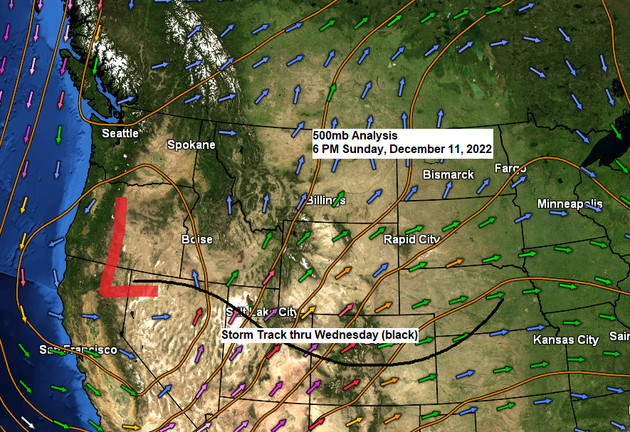
Our well-advertised storm has moved onto the U.S. west coast today, this is the system which will bring significant amounts of snow and mix precipitation to the Northland beginning Tuesday night, with some lingering effects continuing possibly through early Saturday morning as this will be a very slow-moving system.

A look at the storm over the western U.S. today via Goes-16 water vapor loop from Sunday, December 11, 2022.

500mb forecast thru Saturday morning, December 17, 2022.
Lower heights/stormy weather in blue and green
Upper-level ridge/generally quieter weather in red and white

Widespread winter weather alerts in place ahead of this week’s storm.

It continues to look like will see precipitation in the form of snow or a wintry mix move into southern portions of the Northland (south of Duluth) late Tuesday afternoon/evening between 4 PM and 7 PM.
Note – Timing for when this precipitation reaches Duluth continues to change a bit, and that will likely continue over the next 24 hours or so, but currently it looks like will see snow or a mix of precipitation types reach Duluth Tuesday night (around 8 PM to Midnight)
A dry slot is expected to lift from south to north across the Northland Wednesday afternoon, reaching the Twin Ports late in the afternoon or evening, and once this dry slot moves in will see precipitation rates diminish considerably, but some drizzle/freezing drizzle will persist.

Here’s my preliminary snowfall forecast for Tuesday night through Wednesday (ending 7 PM Wednesday)
Additional snowfall accumulations are possible Thursday and Friday.
For Duluth – 6 to 10 inches of snow is possible from late Tuesday night through Wednesday afternoon.
Snowfall totals could end up lower if more mixing occurs Tuesday night and Wednesday.

Wind will be an issue with this storm, with the strongest winds expected to occur near Lake Superior from Tuesday through Thursday when we could see wind gusts of 30 to 40 mph out of the east-northeast.
The combination of these strong winds and snow could lead to near whiteout conditions at times on Wednesday for areas near Lake Superior due to falling and blowing snow.
European model wind gust forecast valid 6 AM Tuesday to 6 AM Friday.

No matter which ensemble model you look at, they all show widespread significant precipitation totals in the Northland this week (ending 6 AM Friday)
These forecasts haven’t changed much for several days now.
Euro ensemble model (EPS)

GFS ensemble model (GEFS)

Canadian ensemble model (CMCE)

A milder than average week ahead for the Northland.

But the arctic flood gates open up for next week with a chance for some bitterly cold air to set up shop for much of next week with several days of subzero daytime highs, while overnight lows fall to the -10s, -20s and possibly even a few -30s.

Thanks for reading!
Tim
Leave a Reply