6:29 PM Friday, March 31, 2023
A significant storm could impact the Northland next week, from Tuesday into Wednesday April 4-5.
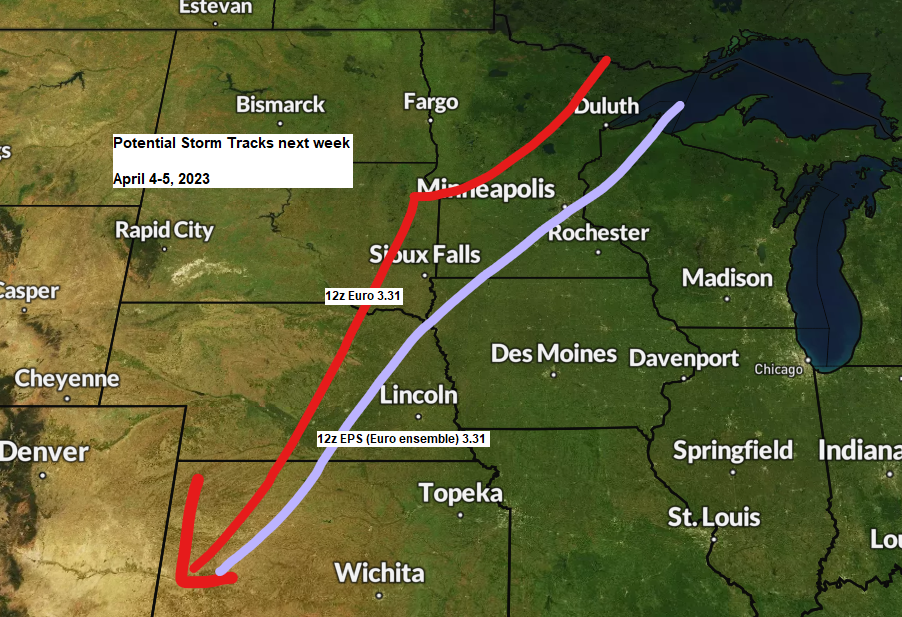
The exact track of this storm is still uncertain, but computer models are in pretty good agreement on a system affecting the Northland around the middle of next week.
A farther west storm track which the European model is showing today would allow warmer air to move into eastern Minnesota and northwest Wisconsin and the Twin Ports which would cause snow to change over to freezing rain, sleet and possibly even rain, while precipitation remains as snow across northern Minnesota.
A farther east storm track which the EPS or European ensemble model shows today would keep colder air over much of the Northland resulting in mostly snow, except in northwest Wisconsin where snow would possibly change over to freezing rain, sleet or rain.
There is potential for significant amounts of snow (6″+) and possibly some ice accumulations with this storm next week.
Again, timing of this would be from Tuesday into Wednesday.


Another component to next week’s storm could be very strong northeast winds near Lake Superior including in the Duluth area with a chance for wind gusts of 40-50 mph, to possibly as strong as 60 to 70 mph. The winds increase Monday night through Tuesday morning and peak in intensity Tuesday afternoon through Wednesday morning.
Euro model wind gust forecast valid 7 PM Monday to 7 PM Wednesday, April 3-5, 2023.

Tim
Leave a Reply