6:08 PM Thursday, April 6, 2023
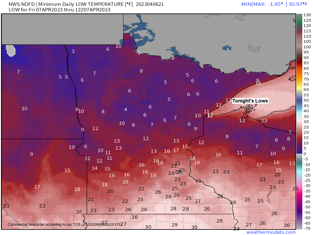
A very cold night ahead with lows ranging from the single digits to lower teens above zero but we could see a few of the traditional cold spots in the Northland drop below zero early Friday morning. Note: Normal lows tonight in northeast Minnesota and northwest Wisconsin range from the lower 20s to the upper 20s.
Record Low Temperatures for April 7th.
International Falls, MN: -9 set in 1982
Brainerd, MN: 0 set in 1936
Hibbing, MN: 0 set in 1982
Ashland, WI: 1 set in 1982
Duluth, MN: 2 set in 1936
A very cold Friday morning in the Twin Ports followed by a chilly Friday afternoon as temperatures only climb to around the freezing mark which is well below average for early April, but winds look pretty light tomorrow, and there should be some sunshine, so it will likely feel a little warmer than what the actual temperature will be.

Much warmer temperatures are likely for next week with chances we get the first 50s and 60s of 2023 looking pretty good right now in Duluth.
This warming trend begins on Sunday when temperatures could make a run at 50 degrees, but a greater chance for 50s and even some 60s are on the way for next Monday-Thursday.
Wind directions will determine how warm temperatures get closer to Lake Superior next week but at the moment it does look like will have a strong enough offshore (warmer) wind direction early to mid-next week with a lake wind returning (much cooler) later next week/next weekend the way it looks now.
The average date for the first 50 in Duluth: March 15th
The average date for the first 60 in Duluth: April 8th

The pattern for next week is looking increasingly more amplified meaning it’ll be a slow-moving pattern with very slow changes to the pattern, so once this new pattern becomes established, it probably won’t be changing much for several days.
Currently it looks like the Northland will be controlled by an upper-level ridge for much of next week which means little if any chance for rain or snow in our area.


Tim
Leave a Reply