5:48 PM Thursday, May 4, 2023
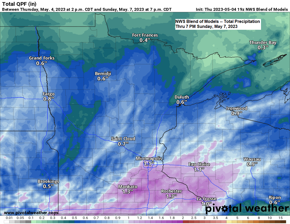
An amplified pattern continues today with a broad trough stretching from Ontario to the Great Lakes into the northeast U.S. with another trough over the far western U.S., in between there’s an upper-level ridge which is starting to break down today as the pattern undergoes some changes, and these new changes will consist of southwest flow aloft across the upper Midwest with troughing off to the west. This trough coupled with increasing amounts of moisture and low-pressure disturbances lifting NE through the region will lead to occasional rain over the next few days, with rain chances in the Northland increasing as we get into Friday night and this weekend. Rain chances will also linger at times next week. So, all in all a wet pattern ahead, although there should be some dry periods mixed in as well.
Low clouds and fog could also become an issue near Lake Superior including in the Duluth area over the next few days as moisture begins to increase.

Goes-16 water vapor loop ending 5:10 PM CT, Thursday, May 4, 2023.

It doesn’t look like will be seeing too much rain across the Northland through the day Friday, but after that we should see some areas of rain move across the area.
NAM 3km model radar forecast thru 1 AM Sunday.

Warm temperatures continued today if you’re far enough away from Lake Superior with temperatures this afternoon in the mid 60s and 70s with even a few 80s in southern Minnesota, but the closer you get to Lake Superior the cooler it gets with temperatures only in the 40s this afternoon along with a northeast wind which has been gusting to around 25 mph.
Expect a similar temperature pattern to persist for several more days with east winds keeping it much cooler near Lake Superior with milder temperatures farther inland.

10-Day Temperature Forecast for Duluth (thru May 14)
Looks like temperatures at least on top of the hill could get back into the 60s mid to late next week, but before then temperatures will be on the cool side when compared to average especially when it comes to the high temps, with even cooler temperatures closer to Lake Superior through much of next week the way it looks now.

Tim
Leave a Reply