6:15 PM Tuesday, May 30, 2023
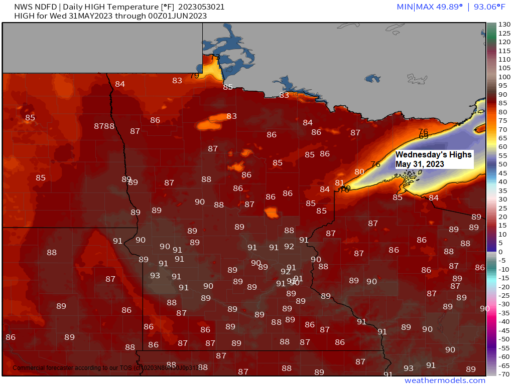
A warm and humid air mass will remain in place across the Northland the next few days with highs mainly in the 80s with lows in the 50s to around 60. Temperatures will continue to be cooler, however, near Lake Superior on a daily basis through this weekend due to a persistent easterly wind, this will keep temperatures in the 50s to around 60 during the day and in the 40s at night within about 10-20 miles of Lake Superior.
It will also remain somewhat humid with dew point temperatures in the 50s and even some 60s at times over the next few days.
Chances for showers and thunderstorms will continue across the Northland on a daily basis through this weekend but note just how scattered this rain has been today per radar rainfall estimates (ending just before 5 PM Tuesday). A similar setup will likely occur the next few days so although rain chances remain in the forecast, this rain will continue to be scattered in coverage meaning not everyone will get rain, but if you do get a thunderstorm, then you likely will get a period of heavy rainfall.
Blue colors on the map below represent one-hour rainfall rates of 0.50″+, with the purple colors representing one-hour rainfall rates of 1.50″+.

Radar loop ending 6 PM Tuesday, May 30, 2023.

Here’s a look at this afternoon’s convection via Goes-16 sandwich imagery with the loop ending at 4:11 PM CT, Tuesday, May 30, 2023.

HRRR model (18z run) radar forecast through 7 PM Wednesday.

Rainfall forecast through 7 PM Wednesday.

Here’s something you don’t see very often. 90 degree temperatures this afternoon near the southern shores of James Bay Canada.
Meanwhile closer to home it’s another warm late spring day with temperatures in the upper 70s to middle 80s in northeast Minnesota and northwest Wisconsin this afternoon with cooler temperatures closer to Lake Superior.
The warmth continues to be widespread across the region today with several locations reporting temperatures of 90 or 91 degrees late this afternoon.

A strong upper-level ridge centered near Buffalo, New York is behind all this warmth across the upper Midwest into central/eastern Canada today.
500mb heights are running +1 to +2 standard deviations above normal under and near this upper ridge today per GFS model analysis.

Tim
Leave a Reply