6:11 PM Thursday, June 1, 2023
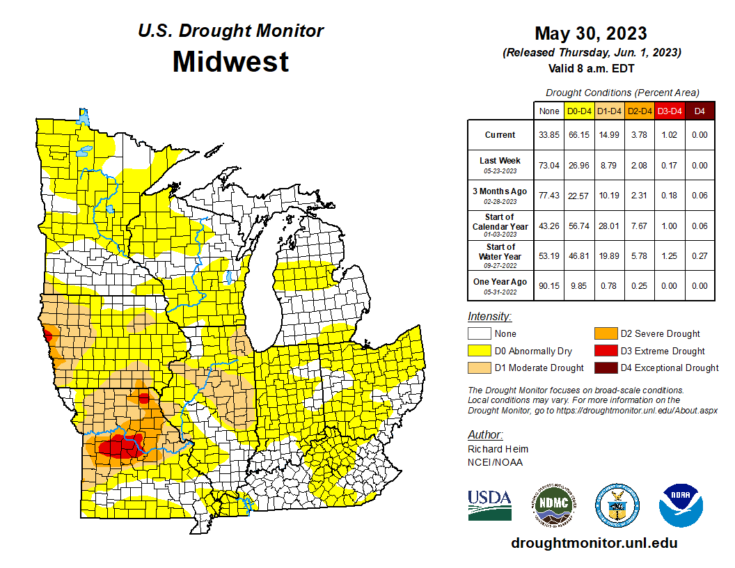
Abnormally dry conditions (yellow) impacting much of Minnesota and Wisconsin in this week’s drought monitor update.
65% of Minnesota is Abnormally Dry which is up from 30% last week.

66% of Wisconsin is Abnormally Dry which is up from 0.82% last week.

Widespread below normal rainfall the last two weeks across the area (red colors)
Note — Rainfall total in Duluth from May 18-31, 2023, was 0.27″, normal amount is 1.63″. This is -1.36″ below normal and is just 17% of normal rainfall during that two week period.

Scattered showers and thunderstorms moved through parts of northeast Minnesota earlier today, and then we saw more scattered showers and thunderstorms pop up this afternoon especially for inland portions of northwest Wisconsin where there’s been some very heavy downpours in spots with hourly rainfall rates >2″ per radar estimates south of Ashland near the Marengo area this afternoon.

The pattern going forward isn’t showing a whole lot of change.
Yes, there will continue to be chances for isolated to scattered rains in the Northland, but nothing widespread in terms of rainfall, so if you do get some rain consider yourself lucky or unlucky depending on how you look at it.
Rain chances will continue to be much lower near Lake Superior, this would also include the Duluth and Superior areas where there probably won’t be much rain possibly through late next week.

More isolated to scattered showers and thunderstorms with torrential downpours on tap for Friday and Friday evening especially for inland portions of northeast Minnesota and northwest Wisconsin.
Note — Rain chances will be much lower closer to Lake Superior Friday.
HRRR model radar forecast valid from 1 PM Friday to Midnight Friday night.

Tim
Leave a Reply