6:53 PM Thursday, June 8, 2023
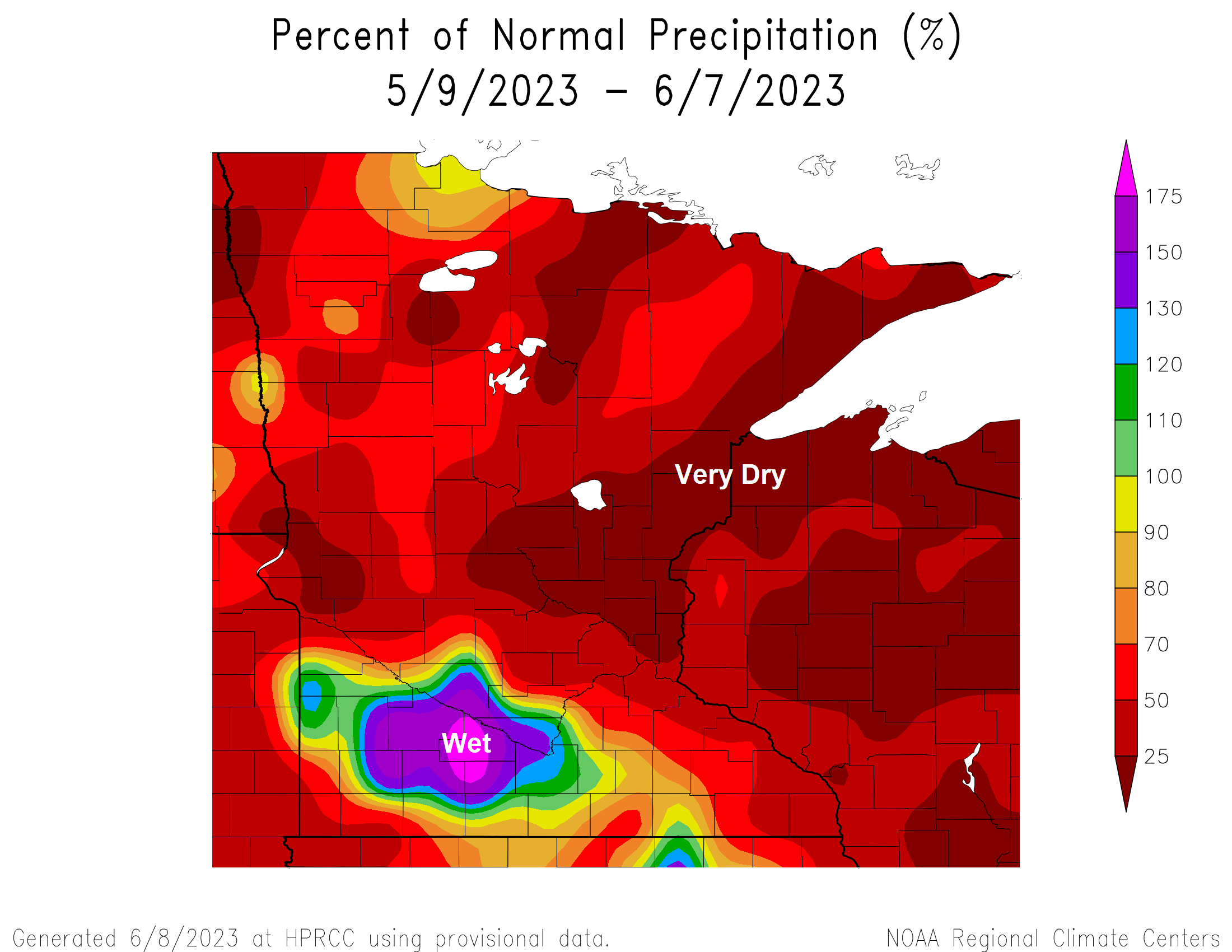
Precipitation totals over the last 30 days were just 25 to 50% of normal in northeast Minnesota and northwest Wisconsin with some parts of the area less than 25% of normal rainfall over the last 30 days.
Note: Duluth’s rainfall total over the last 30 days was only around 10% of normal.
Total Rainfall: 0.34″
Normal: 3.46″
Friday will be a warm one with highs in the upper 70s to lower 80s in northeast Minnesota and northwest Wisconsin and this warm air should even reach locations close to Lake Superior on Friday as will get a brief wind shift to the southwest, but gusty and cool northeast winds will return near Lake Superior for Saturday and Sunday while milder temperatures continue farther inland with highs in the 70s Saturday, and from the mid 60s to low 70s Sunday.
Scattered showers and isolated thunderstorms are likely in the Northland late Friday afternoon into Saturday as a cold front moves SE across the area. Severe weather is not expected with this front, and widespread rainfall is also unlikely to occur, but some of us will get some rain at times late Friday into Saturday, but after this front passes our next shot for getting some rain in the Northland doesn’t look like it’ll be until sometime late next week/next weekend or around or after June 15.
Drought continues to expand across Minnesota and Wisconsin per this week’s drought monitor update.
12% of Minnesota is in Moderate Drought, this is up from <1% last week.
72% of Minnesota is Abnormally Dry, this is up from 65% last week.

25% of Wisconsin is in Moderate Drought, this us up from <1% last week.
88% of Wisconsin is Abnormally Dry, this is up from 66% last week.

Over the last 2 weeks we’ve seen a 1 to 2 class degradation in the drought monitor across the Northland with areas along the North Shore and in far northwest Wisconsin, and also over a small portion of Pine and Burnett County seeing the drought worsen the most (darker orange areas on map)

NAM 3km model radar forecast valid 1 PM Friday to 7 PM Saturday.

Total rainfall through 7 PM Saturday via NWS Blend of Models.

Low Temperature Reports from Thursday morning, June 8, 2023
Source: National Weather Service Duluth, Minnesota
Ashland, WI: 31
Superior, WI: 31
Hayward, WI: 35
Ely, MN: 36
Embarrass, MN: 36
Two Harbors, MN: 37
Grand Marais Airport: 37
Butternut, WI: 38
Solon Springs, WI: 39
Tim
Leave a Reply