10:07 Tuesday, July 4, 2023
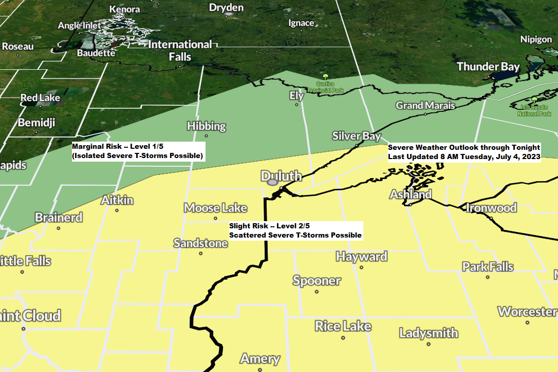
Scattered to isolated strong to severe thunderstorms are possible this afternoon into this evening over portions of the Northland, mainly from east central Minnesota and also including all of northwest Wisconsin. The primary severe weather threats include large hail of quarter size to ping pong ball size (1″ to 1.5″ diameter) and damaging wind gusts to 60 mph.
The potential for showers and thunderstorms will increase generally from SW-NE across parts of the Northland this afternoon with chances lingering into this evening before ending late tonight.
Torrential rainfall is also possible with these storms this afternoon and tonight, and this heavy rain could lead to some areas of flash flooding primarily in east central Minnesota into western Wisconsin (yellow area on map).
A lesser risk for flash flooding exists farther to the north/east (green area on map)

Rainfall Forecast.

HRRR model radar forecast through Midnight tonight.

Thanks for reading!
Tim
Leave a Reply