6:20 PM Wednesday, July 26, 2023
High temperature reports from Wednesday, July 26, 2023
Brainerd, MN: 95 (record high 100 set in 1929)
International Falls, MN: 88 (record high 93 set in 1914)
Hibbing, MN: 87 (record high 91 set in 1941, 2003 and 2015)
Ashland, WI: 82 (record high 95 set in 1929)
Duluth Airport: 81 (record high 92 set in 1929 and 1930)
Local Storm Reports from Tuesday night, July 25, 2023
Source: National Weather Service Duluth, Minnesota
9:32 PM: Thunderstorm Wind Damage. 9 WSW Grand Marais, MN (Cook County) A few fresh trees down along the Cascade River upstream of Highway 61.
9:15 PM: Hail 1.00″ (quarter size) 6 ENE Lutsen, MN (Cook County)
Hovland, MN: Rain — 1.82″
3 WSW Bayfield, WI: Rain — 1.68″
Washburn, WI: Rain — 1.46″
1 N Bayfield, WI: Rain — 1.35″
We saw two main areas of significant rainfall last night into early this morning, one was over the Arrowhead of Minnesota into far northern Wisconsin, the other was over parts of west central through south central Minnesota into southwest Wisconsin.

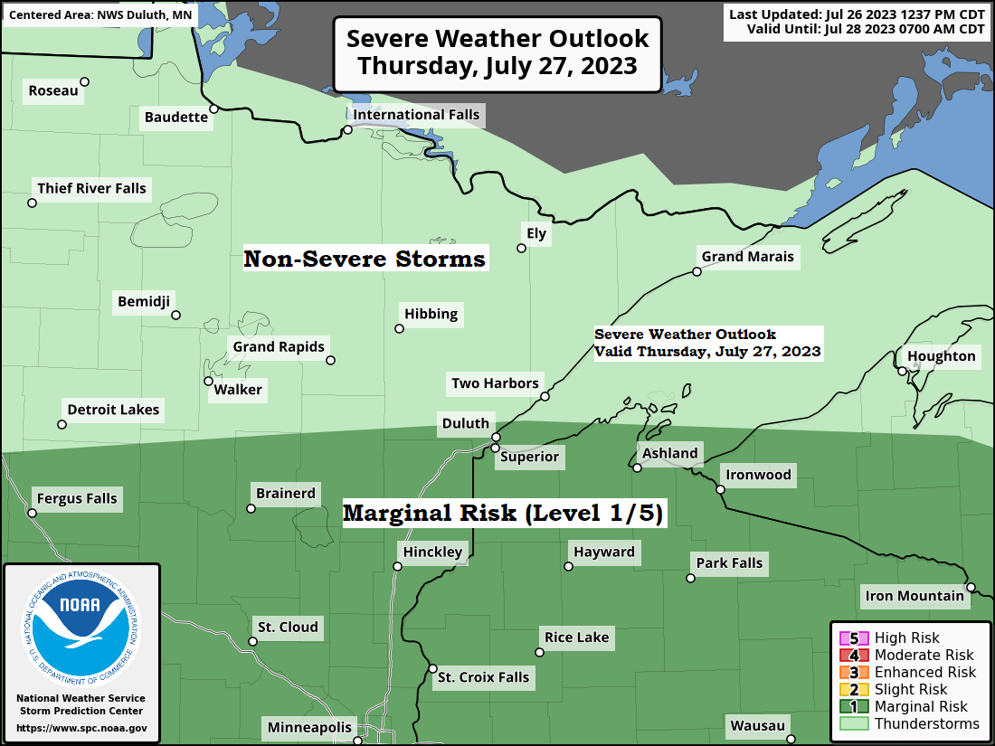
Will continue to have plenty of fuel to support thunderstorm development in the Northland tonight and Thursday with moderate to high amounts of CAPE and low-level juice, but warmer temperatures aloft (CAP) could prevent storms from forming, but this isn’t a guarantee, nor is the chance that will see any rain over the next 24 to 30 hours, but if storms do develop, they could become severe with a threat for damaging winds and large hail. Note — The chances for severe weather are a little higher on Thursday compared to tonight, and that chance covers all of northwest Wisconsin and eastern Minnesota.
Here’s two radar forecasts valid from 10 PM tonight to 7 AM Friday.
Hrrrv4 model

Nam 3km model

An upper-level ridge with 500mb heights of around 598 decameters continues to sit over the southwest US today, but the strength of this ridge has weakened somewhat compared to the last few days when we saw 500mb heights of >6000 decameters, but regardless we continue to see very hot temperatures covering a large portion of the Plains and southwest US again today, with 100-degree temperatures as far north as Bismarck, North Dakota this afternoon.

Lots of heat out there this afternoon if you’re far enough away from Lake Superior as we have temperatures in the upper 80s to low/mid 90s, while upper 60s and 70s were common close to Lake Superior once again this afternoon due to a persistent NE wind.

A muggy air mass covered a large portion of the area this afternoon with dew points in the 60s and 70s, and this muggy feel will continue into Thursday before drier air pushes south/west out of northern Minnesota on Friday.

We have one more very warm to hot day ahead on Thursday with highs in the mid 80s to low-mid 90s (warmest across southern portions of the Northland)
Note — Potential cloud cover and isolated to scattered convection during the day Thursday could keep temperatures a bit cooler than what is shown below, and there is also a chance that will have a northeast wind coming off Lake Superior once again which would also keep temperatures cooler closer to Lake Superior.

Thanks for reading!
Tim
Leave a Reply