5:28 PM Wednesday, November 1, 2023
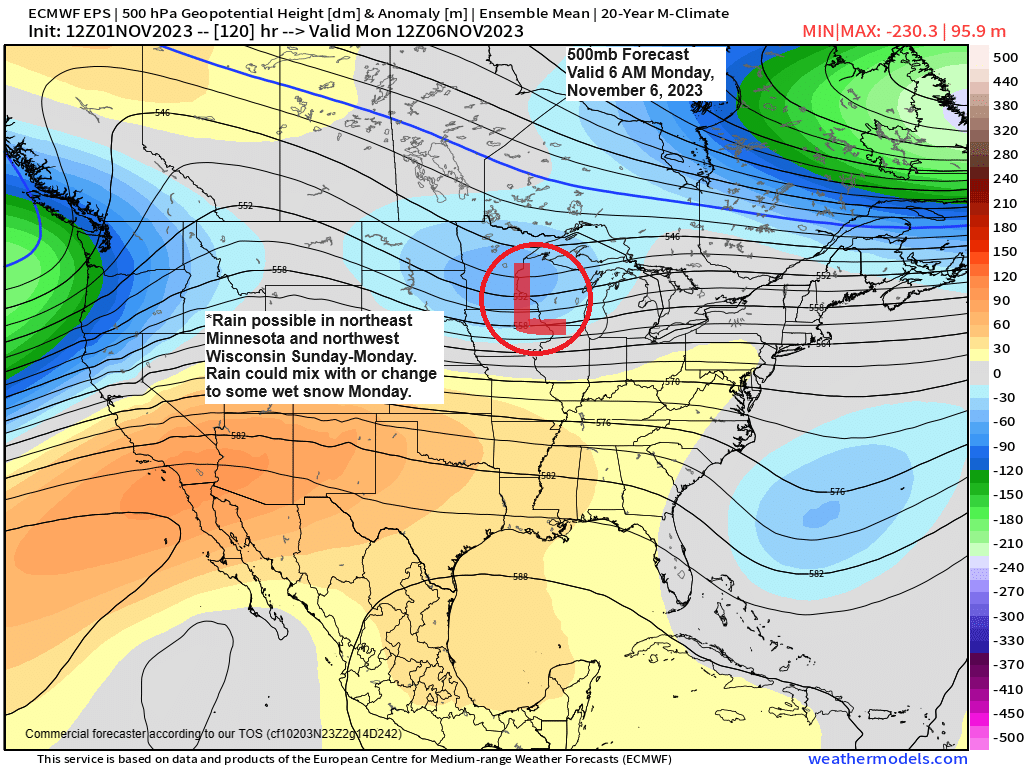
A low-pressure system moving east out of the western High Plains this weekend could affect the Northland in the Sunday-Monday time frame.
Temperatures continue to look warm enough for precipitation to mainly be in the form of rain in much of northeast Minnesota and northwest Wisconsin Sunday and Sunday night with a chance that will see the rain mix with or change to some wet snow in parts of the Northland late Sunday night or on Monday, but at the moment this doesn’t look like a big snow event for our area.
NWS Blend of Models Total Precipitation through 6 PM Monday.
Note — Majority of this precipitation falls Sunday into Monday the way it looks now.

The highest chances for greater than 1″ of snow late this weekend/early next week is in far northern Minnesota into the Arrowhead with lower chances farther south including in the Twin Ports.

Past November Snowfall Totals at Duluth, Minnesota
Period: 2013-2022
Average snowfall in November is 14.1″
Note — Since 2013, there’s been 7 Novembers with below average snowfall in Duluth compared to 3 Novembers which had above average snowfall.
2013: 4.7″
2014: 16.4″
2015: 4.4″
2016: 8.1″
2017: 10.5″
2018: 12.2″
2019: 27.7″
2020: 19.2″
2021: 5.5″
2022: 12.9″
Past November Temperature Anomalies at Duluth, Minnesota
Period: 2013-2022
Average Monthly Temperature in November is 29.8 degrees
Note — Since 2013 there’s been an equal number of warmer than average Novembers (5) to colder than average Novembers (5).
2013: -1.9 degrees
2014: -8.0 degrees
2015: +6.9 degrees
2016: +10.4 degrees
2017: -4.1 degrees
2018: -6.6 degrees
2019: -3.5 degrees
2020: +3.5 degrees
2021: +1.2 degrees
2022: +0.7 degrees
Note — Looks like we had our first subzero temperature of the season in the Northland Wednesday morning with Brimson, Minnesota reporting a low of -1.
Here are some other low temperature reports from Wednesday morning, November 1, 2023.
Hibbing, MN: 4
Solon Springs, WI: 5
2 E Celina, MN: 5
Eveleth, MN: 6
3 W Indus, MN: 8
3 E Orr, MN: 8
Ely, MN: 9
Cook, MN: 9
TEMPERATURE TRENDS FOR NEXT WEEK
Computer models have been trending a little warmer in the Northland for next week, although it still looks like will have below average to near normal temperatures in our area next week.
EPS model

GEFS model
Oldest model run is Days 8-12 on the loop below, and the newest model run is Days 6-10.
Blue colors: Below average temps
Orange colors: Above average temps

Thanks for reading!
Tim
Leave a Reply