5:49 PM Thursday, November 16, 2023
-Strong northwest winds with gusts of 25 to 45 mph tonight. Less windy on Friday.
-Temperatures falling into the 20s and lower 30s tonight with highs Friday in the mid 30s to low 40s which is actually very close to normal for this time of the year.
-Turning a little warmer this weekend with afternoon temperatures mainly in the 40s.
-Some precipitation possible next Monday-Tuesday with both rain and snow with a transition to mostly snow expected by Tuesday. No significant snow accumulations are expected early next week.
A windy day across the Northland.
Here are the peak wind gusts from today, Thursday, November 16, 2023.
Source: National Weather Service Duluth, Minnesota
Ashland, WI: 53 mph
Hayward, WI: 48 mph
Pine River, MN: 44 mph
Duluth Sky Harbor Airport: 43 mph
Duluth Airport: 41 mph
Proctor, MN 2 SSW: 41 mph
Hibbing, MN: 41 mph
Grand Rapids, MN: 41 mph
Cass Lake, MN 1 E: 40 mph
Moose Lake, MN 2 ENE: 40 mph
Widespread very mild temperatures today from Nebraska to northeast Minnesota, east to Wisconsin, Illinois and upper Michigan.
A new daily record high temperature was set today at Ashland, Wisconsin with a high of 68 degrees. The previous record high temperature for November 16th was 64 degrees set in 1931 and 1953.
Note — High of 62 at the Duluth Airport today (November 16, 2023) This is the 1st official 60 we’ve seen in Duluth since October 17th, and today’s high of 62 is the warmest temperature in Duluth since October 15th when the high was also 62. The average date for the last 60 in Duluth is October 26th. The latest last 60 on record is on November 27th set in 1998.

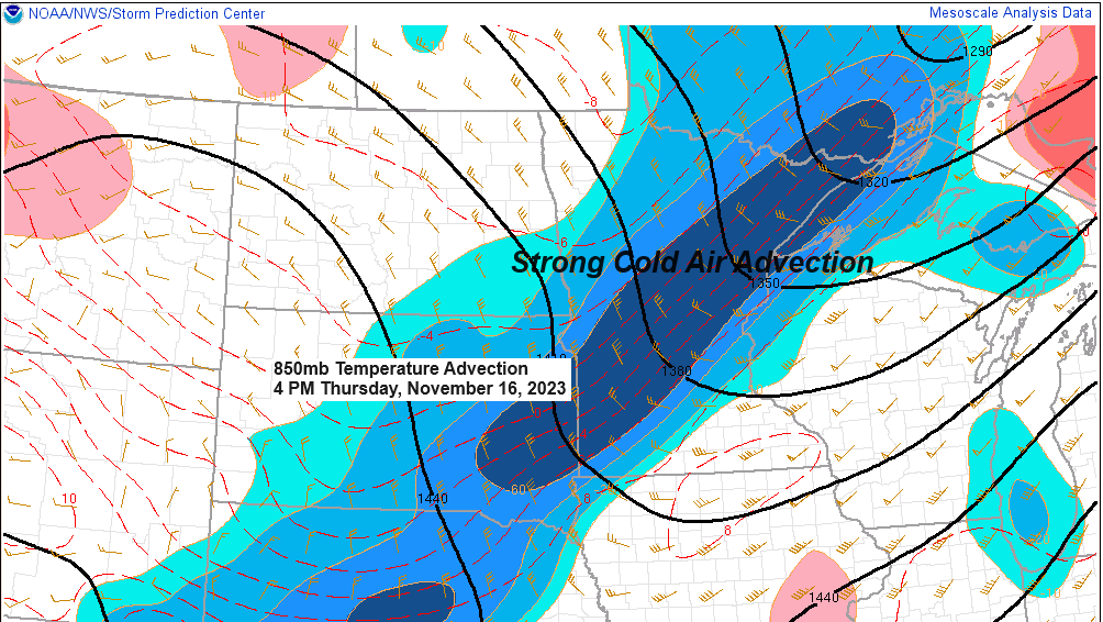
Cold air is on the move late today.

The system moving across the upper Midwest today has a lot of dynamics with it but it’s lacking moisture big time which is why we haven’t seen any precipitation today.
Winds at 500mb (~18,000 feet) are cranking this afternoon with speeds of 80 to >90 knots across northern Minnesota.

Goes-16 water vapor loop from Thursday, November 16, 2023 (loop time ends 4:30 PM CT)

Looks like will stay mostly dry in the Northland through this weekend, but chances for some rain and snow remain in the forecast for next Monday and Tuesday with some light snowfall accumulations possible Monday night and Tuesday.
Note — Much colder temperatures continue to look likely in the Northland mid to late next week with highs in the 20s and overnight lows in the single digits and teens.

Thanks for reading!
Tim
Leave a Reply