5:34 PM Saturday, December 16, 2023
Abundant moisture after Friday’s rain and snow combined with fairly light winds today has led to the development of dense fog in parts of the northeast and east central Minnesota today with visibilities <1 mile in some locations.
Areas of dense fog will persist in northeast and east central Minnesota tonight while expanding farther east into parts of northwest Wisconsin, and this fog will probably linger into mid-morning on Sunday before winds increase which should lead to the fog dissipating by Sunday afternoon.
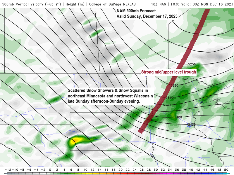
A potent cold front will move southeast across the Northland Sunday afternoon/evening and as this front moves through will likely see scattered snow showers develop with some brief bursts of heavy snow possible which could lead to a light coating of snow accumulation in some parts of the area late Sunday afternoon/evening.
Note — Still haven’t recorded a subzero temperature in Duluth this month, and odds that we get at least 1 subzero temperature the rest of this month are pretty low. There’s been 6 years dating back to 1874 which had no subzero low temperatures in December in Duluth, see below.
2015
1959
1918
1913
1888
1877
What a difference a year makes in the snowfall department.
Snowfall comparisons for Duluth, Minnesota through December 16th.
2023: Total 5.2″, -21.4″ below normal. 20% of normal snowfall.
2022: Total 51.6″, +25″ above normal. 194% of normal snowfall.
Late Saturday afternoon weather conditions
Gray=Fog
Red=Freezing Fog

FOG TONIGHT
Dense fog advisory in effect until Midnight tonight for parts of northeast and east central Minnesota. Visibility one quarter to one half mile in dense fog.

SNOW SHOWERS/SQUALLS LATE SUNDAY AFTERNOON-EVENING
NAM 3km model radar forecast valid 12 PM Sunday to 6 AM Monday.

BRISK/CHILLY MONDAY
Colder temperatures will be found in the Northland on Monday as a strong upper trough pushes southeast out of central Canada, but this cold air won’t stick around long as warmer temperatures return already by Tuesday.
Highs on Monday are forecast to be the upper teens to lower 20s with lows Sunday night and Monday night in the single digits and teens.
European model 500mb forecast for Sunday.

LONG RANGE OUTLOOK
No signs of any persistent arctic air masses impacting the Northland for the rest of this year.
We’re looking at a continuation of above average temperatures for the most part through December 31st, with only a brief shot of colder (more seasonable) temps mixed in early next week.
Highs in the 30s from the middle of next week through Christmas with a few 40s also possible on a few days between the 20th and 25th.
EPS model temperature anomaly forecast valid December 20-25, 2023.

EPS model temperature anomaly forecast valid December 26-31, 2023.

Thanks for reading!
Tim
Leave a Reply