6:39 PM Tuesday, January 9, 2024
Another long duration but mostly light snowfall event is on the way the next few days as a complex setup develops which will include an area of low pressure approaching from Saskatchewan while another low or two tracks east/northeast across the Central Plains which will be followed by a much stronger low which lifts quickly northeast out of the southern Plains late this week. While all of this is happening, arctic air will begin to ooze south out of Canada.
Light snow could begin during the day Wednesday and some snow will probably continue at times all the way through Friday night or Saturday morning, but again it doesn’t look like will be seeing much accumulation with most of the Northland only getting about 1 or 2 inches of snow the next few days, but there is an exception to this (almost always the case) and that would be near Lake Superior where much higher snowfall amounts are possible where lake effect snow bands setup from Wednesday through Saturday.
At the moment it looks like the North Shore of Lake Superior could see some lake contribution Wednesday through Friday, with the South Shore getting in on some of this action especially by Friday and Saturday. 3 to 6 inches or more of snow is possible in spots near Lake Superior from Wednesday through Saturday and given the duration of this event, it’s possible we could see double digit snow totals in some locations.
Duluth area: 1 to 2 inches of snow from Wednesday through late Friday night, but there is a chance that we could see lake effect snow bands affect parts of the city at times which could lead to higher snowfall amounts. At the moment it looks like our best chance for possibly getting some lake effect snow in Duluth would be on Friday as we could see more of an east-northeast wind develop at least for a few hours. Most of the lake effect snow Wednesday and Thursday should stay northeast of Duluth the way it looks now.

Lake effect snow showers along the South Shore of Lake Superior tonight will gradually shift northwest onto the North Shore Wednesday as winds shift from north to the southeast, while synoptic snow develops or spreads east into the Northland Wednesday/Wednesday night.
NAM 3km model radar forecast through 6 AM Thursday.

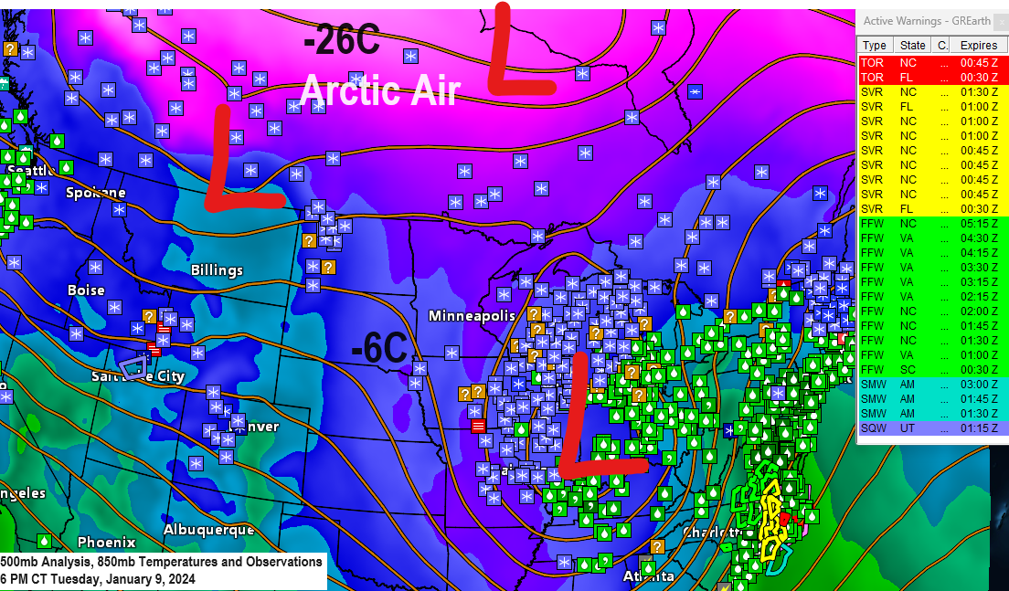
Widespread arctic air continues to cover central and northern Canada today with temperatures as cold as the -20s, -30s and even a few -40s.
This arctic airmass will finally push south into the Northland this weekend with a period of frigid temperatures looking pretty likely this weekend into much of next week with afternoon temperatures in the single digits below to single digits above zero in the Northland while overnight/morning temperatures range from the single digits below to around 20 below zero. Note: Some moderation in temperatures especially in high temperatures could occur mid to late next week.

A powerful storm with a central pressure of around 28.90″ located near Detroit late this afternoon continues to lift to the northeast, and this low will move over Lake Huron by early tomorrow morning.
Widespread snow west of the low with rain near/east of the low today.
Some double-digit snow totals reported in eastern Iowa today associated with this big storm.

What a widespread and powerful storm lifting northeast across Michigan late this afternoon.
Goes-16 infrared satellite loop ending 4:55 PM Tuesday.

Goes-16 water vapor loop ending 4:55 PM Tuesday.

Looks like will see another strong low-pressure system lift northeast out of the southern Plains late this week with this low taking a pretty similar path to today’s system.
There is a potential for another round of heavy snow and strong winds Friday-Saturday in parts of the Midwest and for the southern/eastern Great Lakes region.

Thanks for reading!
Tim
Leave a Reply