6:31 PM Monday, March 4, 2024
A chilly night ahead as temperatures fall into the single digits and teens above zero in northern Minnesota while much of northwest Wisconsin will see their temperatures drop into the teens and 20s.
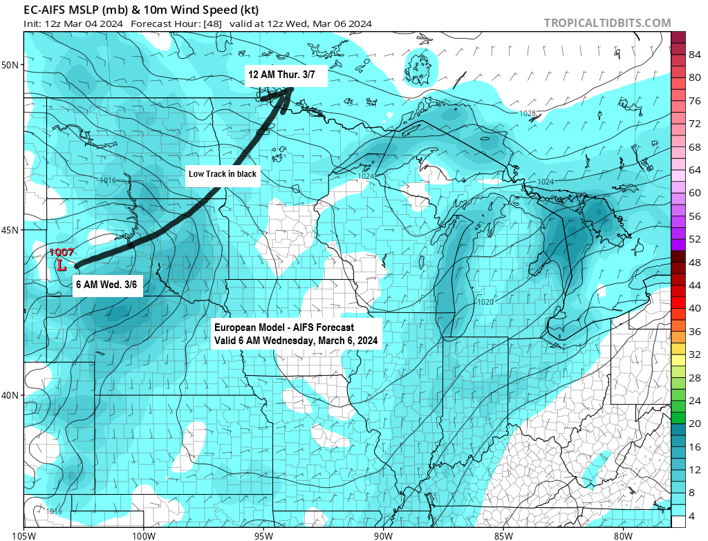
Tuesday is looking dry across the Northland, but there are chances for some snow or rain Wednesday into Thursday as an area of low-pressure tracks northeast out of the western High Plains. This doesn’t look like a major system for our area, but parts of northern Minnesota could see around a trace to 2 inches of snow accumulation between Wednesday and early Thursday morning.
A few rain or snow showers are also possible at times in Duluth Wednesday afternoon into early Thursday morning but little to no snow accumulation is expected the way it looks now.
As for temperatures, we’re looking at highs mainly in the 30s and 40s through Friday with a few 50s possible Wednesday and Thursday mainly in east central Minnesota and northwest Wisconsin.
European model simulated radar forecast valid 6 AM Wednesday to 6 AM Thursday.
Snow in blue, rain in green.

It’s been a stormy Monday in parts of the Midwest as scattered severe thunderstorms have been moving through parts of southern Wisconsin, northwest Illinois into far eastern Iowa with numerous reports of large hail ranging from quarter size to as large as golf ball size.
In the colder air farther north, there’s been an area of wet snow which has been heavy at times in parts of west central into northeast Wisconsin today.
Radar colors
Snow (blue)
Rain (green)
Yellow outlined areas=Active severe thunderstorm warning as of 4:58 PM Monday.
Orange icons=Hail reports
Gray icons=Wind reports

Temperatures in western/southern Minnesota into central Iowa and western/southwest Wisconsin were running about -20 to -35 degrees colder at 1 PM today (Monday) compared to 1 PM Sunday.

A broad southwest mid and upper-level flow in place east of the Rockies today.

Here’s a look at the system passing east of the Northland today as seen on infrared satellite imagery.
Goes-16 infrared satellite loop ending 4:51 PM CT Monday.

It’s an active weather pattern with several systems stretching from the western U.S. through the southern/eastern U.S., up into the Great Lakes, but the Northland is escaping all this active weather today.
Goes-16 water vapor loop ending 4:56 PM CT Monday.

More above average temperatures across the Northland the rest of the week.

And more of the same for next week.

Thanks for reading!
Tim
Leave a Reply