5:38 PM Monday, March 18, 2024
This post will be on the second system which could impact the Northland from Saturday night or Sunday morning through about next Tuesday or Wednesday.
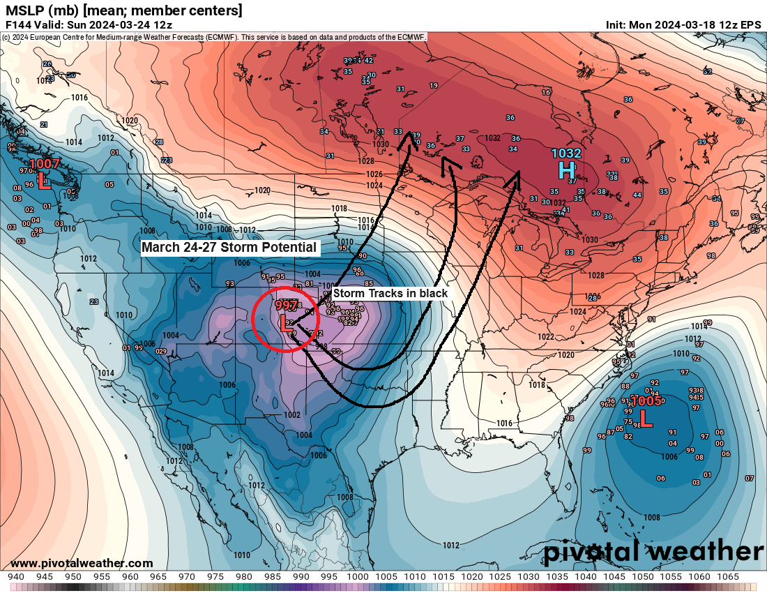
There is still quite a bit of uncertainty on how this second system will evolve and what the track of this system will be.
There’s a chance we could be dealing with two separate lows, with a lead low affecting us Sunday-Monday morning, followed by a potential hook-type low which lifts north out of the southern Plains early next week in the late Monday through early Wednesday time frame.
Potential hazards for late this weekend into early next week include
- Gusty winds (strongest near Lake Superior)
- Snow, possibly heavy at times
- Rain and freezing rain
Highest calendar day snowfall totals in Duluth this winter
- 2.9 inches on January 10th
- 2.3 inches on January 6th
- 1.5 inches on January 5th
Those purple colors on the map below represent snow totals of 12 inches or more through next Wednesday. Keep in mind this includes both events, the one late this week, and the other this weekend into the middle of next week, and this forecast is from the NWS Blend of Models.

EPS 50-member snowfall forecast for Duluth
Through next Wednesday, March 27, 2024.
- 30/50 EPS members forecast 10 or more inches of snow
- 6/20 EPS members forecast 20 or more inches of snow with a high-end amount of 40 inches.

The potential for a widespread significant ice storm has diminished somewhat in the Euro model today, but this model still shows a chance for some significant ice accumulations mostly over parts of northwest Wisconsin into far northeast Minnesota early next week.

The spread on potential ice accumulations in Duluth for next week ranges from nothing to a high-end amount of 0.30 inches via EPS model forecast.

It still looks like will be dealing with gusty northeast winds near Lake Superior and in Duluth late this weekend with east to northeast winds of 20 to 45 mph Sunday into Monday.
European model wind gust forecast valid 7 AM Sunday to 7 PM Monday, March 24-25, 2024.

Thanks for reading!
Tim
Leave a Reply