5:58 PM Sunday, March 31, 2024
A much quieter week of weather ahead in the Northland this week compared to last week’s major and slow moving winter storm.
- No significant precipitation events affecting the Northland at least through next weekend (April 7th)
- Pattern could turn more active after April 7th but if it does, we could be looking at more rain than snow for a precipitation type.
- East winds will keep temperatures in the 30s near Lake Superior Monday and Tuesday, and more east winds are likely late this week through next weekend so temperatures near Lake Superior will be cooler (30s and 40s) compared to the temperatures farther inland (50s to around 60), but it is spring after all.
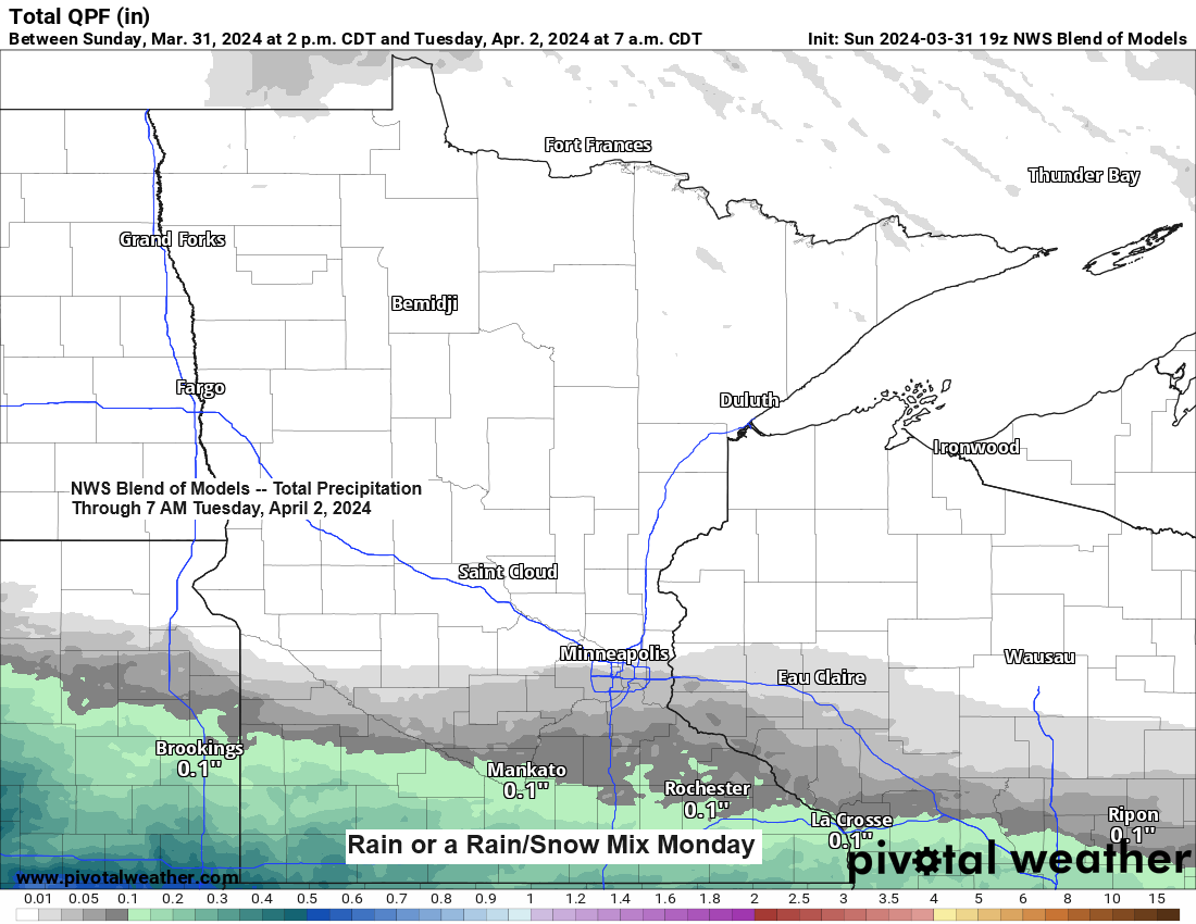
The storm track this week will stay well south of the Northland as will see the next system over the central/southern Rockies today move pretty much due east through the Midwest and then will turn northeast towards the eastern Great Lakes by midweek. All of the precipitation with this system will stay south of the Northland over the next few days.

Some rain or a mixture of rain and snow is possible in parts of southern Minnesota on Monday.
HRRR model simulated radar forecast valid 7 AM to 7 PM Monday.

There is one minor issue will have to get through on Tuesday and that is a fairly strong mid and upper-level area of low pressure which will dig south/east out of eastern Manitoba and Ontario. This system could bring some rain and snow showers to parts of the Northland on Tuesday, and there is also a chance for some heavier snow squalls/ice pellets to develop on Tuesday depending on how things setup, and also on the track of this upper level system.
Here’s the NAM 500mb vorticity forecast valid 7 AM Tuesday to 7 AM Wednesday.

Severe thunderstorms possible the next few days.
Tonight’s risk covers parts of northern Missouri, far southern Iowa into central Illinois and central Indiana. Large hail is the primary hazard tonight.

The potential for severe thunderstorms covers a much larger area on Monday and the risk increases to Enhanced (level 3/5) in the orange area on the map. All severe hazards are on the table Monday including large hail, damaging winds, and a few tornadoes.

Finally on Tuesday the risk for severe thunderstorms shifts farther east and includes another Enhanced Risk (level 3/5) orange area on the map. Once again, all severe hazards are in play including large hail, damaging winds, and a few tornadoes.

The pattern by late this week looks to become quite amplified which is pretty typical in the spring.
Two deep troughs one to the east and the other to the west with a strong ridge in between. Eventually the ridge moves away and will likely be replaced by a trough moving east out of the Rockies, but this probably won’t happen until around or after April 7th.

Thanks for reading!
Tim
Leave a Reply