5:16 PM Monday, April 8, 2024
- Light rain, drizzle, and areas of fog tonight.
- Isolated showers Tuesday.
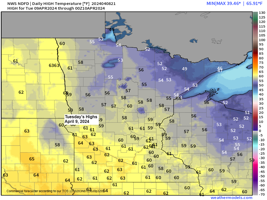
- Milder temperatures return to the Northland Tuesday with highs in the 40s and 50s with even warmer temperatures expected Wednesday with highs in the 50s and 60s.
- Scattered rains Wednesday and Thursday.
Will continue to see some light rain and drizzle in much of the Northland tonight although the coverage of this rain should diminish during the night. Some patchy fog is also likely tonight.
Tuesday looks much drier compared to today, but we could still see a few isolated showers popup in spots.
NAM 3km model simulated radar forecast through 7 AM Tuesday.

Additional rainfall amounts ranging from around 0.05 inches to 0.30 inches are likely in much of the Northland tonight.

Low pressure has moved into north central Minnesota late this afternoon with the center of this low located between Grand Rapids and McGregor as of 4 PM today. This low will continue to lift northeast reaching southern Ontario around daybreak on Tuesday.

A broad upper level low/trough covered the upper Midwest today with a ridge farther off to the northeast.

A look at today’s system impacting the upper Midwest via Goes-16 satellite imagery.
Visible satellite loop ending 3:51 PM CT Monday, April 8, 2024.

Water vapor loop ending 3:40 PM CT Monday, April 8, 2024.

As one trough pulls away from the Northland on Tuesday a new one develops Wednesday and Thursday as a trough digs south/east out of the northern Plains while another trough lifts northeast out of the southern Plains.

The net result from this next trough will be for the potential for scattered showers to develop in the Northland Wednesday afternoon into Thursday.
There’s even some weak amounts of CAPE (instability) present on Wednesday which could lead to a rumble or two of thunder during the afternoon and early evening.
NAM 3km model simulated radar forecast valid 1 PM Wednesday to 1 AM Thursday.

As we get into next week, we could see some active weather once again as another large-scale trough develops over the western U.S.
The track of this trough, and where low-pressure systems develop and track are uncertain right now, but the potential is there for some active weather in the upper Midwest next week.

Watch the track of today’s solar eclipse on Goes-16 satellite imagery.
The eclipse can be seen by the dark area on the loops below which tracks northeast from Mexico into the Ohio Valley and northeast U.S. today.
1st loop ends 2:15 PM CT Monday.

2nd loop ends 2:30 PM CT Monday.

3rd and final loop ends 2:46 PM CT Monday.

Thanks for reading!
Tim
Leave a Reply