5:34 PM Monday, April 29, 2024
The active weather pattern is set to persist, presenting multiple opportunities for rainfall in the future.
Updated precipitation totals for April 2024 through 4 PM on the 29th
Brainerd, MN: 3.02″, +1.49″ above normal
Duluth, MN: 2.47″, +0.04″ above normal
Hibbing, MN: 2.33″, +0.79″ above normal
Ashland, WI: 2.02″, -0.14″ below normal
International Falls, MN: 1.27″, -0.30″ below normal
Here’s a look at when we could see some sun and dry weather in Duluth.
- Tuesday afternoon
- Wednesday afternoon
- There may be a recurrence between Friday afternoon and Sunday, although confidence is low due to varying solutions in computer model data late this week into this weekend.
Light rain and drizzle are likely to continue in parts of the Northland into the evening but will likely dry out overnight and for most of Tuesday. A new round of rain is predicted to sweep northeast across the Northland, beginning late Tuesday afternoon and lasting into early Wednesday morning.
Note: Fog is expected to continue in parts of the Northland throughout much of the night.
The next round of rain is expected to arrive in the Duluth area on Tuesday evening, after 6 PM.
European model simulated radar forecast through 7 PM Wednesday.

The upcoming weather system is expected to bring rainfall totals ranging from 0.25 to 0.75 inches in northeast Minnesota and northwest Wisconsin.

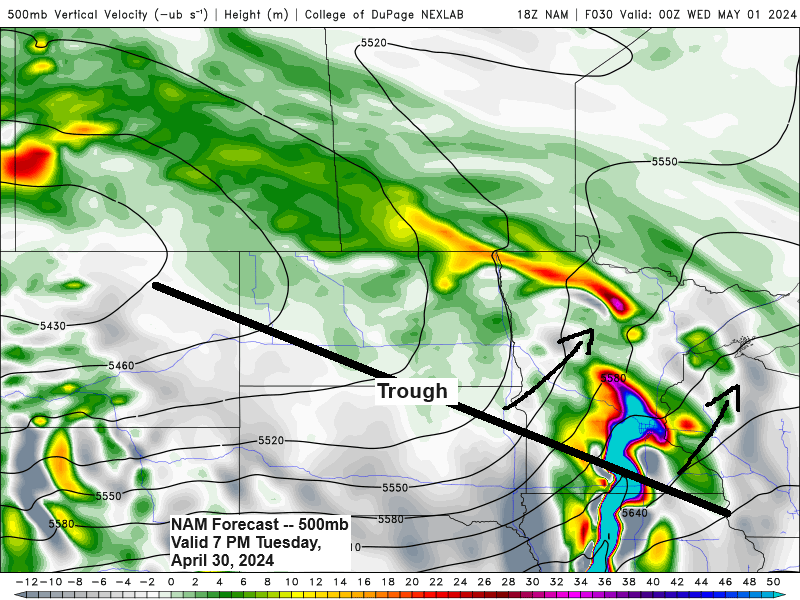
The upcoming weather system targeting the upper Midwest is expected to produce a range of isolated to scattered strong and potentially severe thunderstorms across southern Minnesota and western/southwestern Wisconsin from Tuesday afternoon through the evening.

In addition to the possibility of large hail measuring 1 to 2 inches in diameter and damaging winds exceeding 60 mph, there is also a risk of a few tornadoes late Tuesday afternoon and evening in southern Minnesota and western/southwestern Wisconsin, with the highest likelihood in the brown area indicated on the map below.

This is an overview of the severe thunderstorm risk for Tuesday.

There’s a possibility of more rain in the Northland from Thursday into early Friday morning as another low-pressure system moves northeastward from the Plains.
European model simulated radar forecast valid 7 AM Thursday to 1 AM Friday.

We continue to experience the effects of our current system as a low-pressure area moves slowly northeastward out of northern Wisconsin this afternoon. The Northland finds itself on the trailing edge of this system, resulting in mostly light rain showers, drizzle, and patches of fog across the region.

A well-defined system is moving northeast across the upper Midwest, as observed in today’s water vapor imagery.
Goes-16 water vapor loop ending 4:31 PM CT, Monday, April 29, 2024.

And here’s a look at the 500mb analysis from Monday afternoon.

Thanks for reading!
Tim
Leave a Reply