5:56 PM Tuesday, April 30, 2024
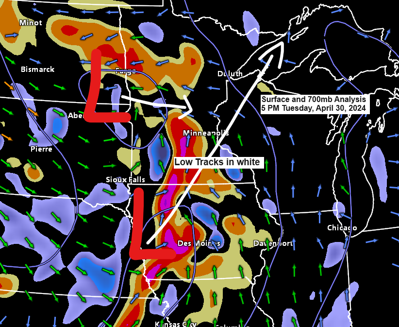
Rain is expected in the Northland tonight as a strong trough moves northeast from the northern Plains. This trough will produce strong uplift, resulting in heavier downpours across parts of the Northland.
The rain is expected to cease Wednesday morning, followed by a dry spell in the afternoon and evening. However, another bout of rainfall could occur from Thursday through early Friday, and then again on Saturday. A more significant system may arrive early to mid-next week.
The greatest instability with this system will stay well to the south of the Northland tonight. However, the possibility of an isolated thunderstorm, particularly over eastern Minnesota and northwest Wisconsin, cannot be completely dismissed. Nonetheless, no severe weather is anticipated in our region tonight.

Duluth area: Rain is expected to start tonight between 8 PM and 10 PM, and it should conclude early Wednesday morning, sometime between 5 AM and 7 AM.
NAM 3km model simulated radar forecast through 1 PM Wednesday.

Northeast Minnesota and northwest Wisconsin are expected to receive at least a half-inch of rain tonight through Wednesday morning, with some areas potentially seeing as much as 0.75 to 1 inch.

Numerous severe thunderstorm warnings and a tornado warning have been issued late this afternoon across parts of the central and southern Plains.

The next weather system is moving east-northeast across the Dakotas this afternoon.
Goes-16 water vapor loop ending 4:21 PM CT Tuesday, April 30, 2024.

Late this afternoon, thunderstorms have been observed in western Iowa, southeast Nebraska, and eastern Kansas, with additional storms affecting the far southwest region of Minnesota.
Displayed is the GOES-16 lightning mapper data concluding at 4:21 PM CT on Tuesday, April 30, 2024.
Note: Lightning can appear in green, yellow, orange, and red colors on the loop below.

After a mostly cloudy day, Duluth enjoyed a welcome break with some late afternoon sunshine, a pattern echoed across the Northland. However, clouds are gathering from the west, moving north/east across Minnesota, signaling the approach of the next rain system.
Goes-16 visible satellite loop ending 4:21 PM CT Tuesday, April 30, 2024.

Thanks for reading!
Tim
Leave a Reply