5:36 PM Wednesday, May 29, 2024
The forecast indicates another chilly night with the possibility of patchy frost affecting areas of northeast Minnesota and northwest Wisconsin.
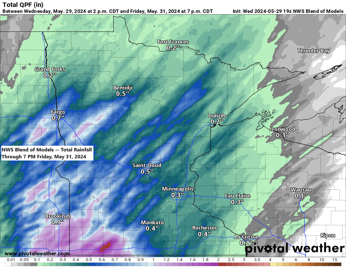
Rain is expected intermittently from Thursday evening through early next week, although there will be periods without rain as well.
Timing of when we could see some rain and dry times for Duluth are as follows
- Rain is expected late Thursday night into Friday morning, starting after midnight and concluding between 5 and 7 AM on Friday.
- The remainder of Friday is expected to be dry, however, another bout of rain could occur from late Friday night into Saturday morning.
- A period of dry weather may occur from Saturday afternoon until Sunday morning.
- Additional rainfall may occur from Sunday afternoon through early Monday morning.
Here’s the NAM 3km model radar forecast valid from 1 Thursday to 7 PM Friday.

Rainfall of up to a quarter-inch is expected in northeast Minnesota and northwest Wisconsin from Thursday night into Friday morning. There may be areas with heavier rainfall, potentially exceeding half an inch.

- Frost Advisory (blue area on map) in effect from 1 AM to 9 AM Thursday for the Arrowhead of northeast Minnesota and for parts of northwest Wisconsin including the cities of Grand Marais, Silver Bay, Isabella, Two Harbors, Hibbing, Virginia, Superior, Solon Springs, Washburn, Bayfield, Port Wing, Ashland, Hurley, Hayward, and Winter.
- Temperatures as low as 34 degrees may result in patchy frost formation in the advisory area.

Note: Tonight may be the last night for some time with a likelihood of frost in the Northland.

With just two days remaining in meteorological spring, which spans from March 1st to May 31st, let’s review the temperature trends in Duluth.
- This spring in Duluth has seen 26 days with high temperatures reaching at least 60 degrees, surpassing the average of 20 days.
- So far this spring, Duluth has experienced at least 70 degrees on five days. The average is typically seven days.
- This spring, Duluth has experienced at least one day with high temperatures reaching 80 degrees. On average, there are two such days during the spring season.
In Duluth this spring, 57% of the days experienced temperatures above the average, while 33% had temperatures below the average.

The spring of 2024 has brought temperatures in the Northland that are above average by approximately 1 to 2 degrees.

Average temperature and departure from normal for Spring 2024 (March 1 – May 28)
Brainerd, MN: 44.0 degrees, +2.4 degrees above normal
Duluth, MN: 41.2 degrees, +2.2 degrees above normal
Gordon, WI: 41.2 degrees, +1.6 degrees above normal
International Falls, MN: 38.6 degrees, +1.7 degrees above normal
Hibbing, MN: 38.2 degrees, +2.0 degrees above normal
Looking ahead to next week, there could be a potentially large trough or a slow-moving upper-level system developing somewhere from the upper Midwest and Great Lakes region, extending southward to the Ohio Valley.
Computer models continue to analyze the potential setup of this trough, indicating that changes to the forecast may occur in the coming days.

If this trough develops, we might experience several days of relatively cool temperatures in the Northland area late next week or next weekend. Meanwhile, much of the western US is anticipated to have very warm, if not hot, temperatures next week.

Low temperature reports from Wednesday morning, May 29, 2024
Orr, MN: 34
Hibbing, MN: 35
Hayward, WI: 35
International Falls, MN: 36
Ely, MN: 36
Crane Lake, MN: 36
Cook, MN: 36
Eveleth, MN: 36
Aitkin, MN: 36
Walker, MN: 37
Ashland, WI: 37
Bigfork, MN: 37
Siren, WI: 37
Grand Rapids, MN: 38
Superior Airport: 38
Thanks for reading!
Tim
Leave a Reply