6:30 PM Friday, January 10, 2025
-Another round of snow is likely in the Northland this weekend with greater snow accumulations compared to the event we saw on Thursday which dropped anywhere from around 0.5 to around 1.5 inches of snow.
– Winter Weather Advisories have been issued for the Arrowhead and North Shore from Saturday afternoon to Sunday evening, with a potential for some heavier lake-enhanced snowfall.
– A shot of Arctic air will follow this system early next week, with a more impressive and longer-duration surge of Arctic air possibly impacting the Northland the week of January 19th.


- Snow is forecast to spread from west to east across Northland during the day on Saturday.
- Snow tapers off from west to east on Sunday, but snow is forecast to linger the longest over the Arrowhead of Minnesota.
- Duluth area: Snow begins Saturday afternoon around 12 PM to 4 PM. The wide range in onset timing is due to differing solutions produced by the computer models today, with some models showing an earlier start to the snow, while others delay the snow until later in the afternoon. Snow ends during the day on Sunday, most likely before noon.
NAM 3km model simulated radar forecast valid 6 AM Saturday to Midnight Sunday night.

Here’s my snowfall forecast for this weekend ending 6 PM Sunday.
-Much of the Northland should see at least 2 inches of snow from this system, with a potential for up to 3 to 4 inches.
-The Arrowhead of Minnesota could see 5 to 8 inches of snow.
-Isolated snowfall totals of up to 5 inches are possible from the north/east side of Duluth to Two Harbors to Silver Bay.
Duluth area: About 2 to 4 inches of snow between Saturday afternoon and Sunday morning.

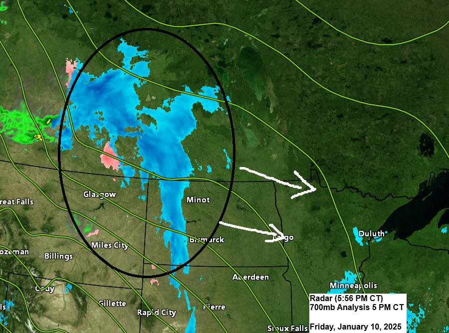
Track of this weekend’s clipper.

Make a one-time donation
Make a monthly donation
Make a yearly donation
Choose an amount
Or enter a custom amount
Your contribution is appreciated.
Your contribution is appreciated.
Your contribution is appreciated.
One shot of arctic air will move over the Northland starting Sunday night and lingering through about Tuesday night as we will see 850mb temperatures bottom out around -20 to -25°C with highs in the single digits below to single digits above zero in the Northland on Monday, and mainly in the single digits above zero next Tuesday. Lows in the single digits, teens, and 20s below zero are forecast from Sunday night through Tuesday night.

There is strong model agreement regarding the temperature trends for the week of January 19th, and they all look frigid in the Northland right now.
Lows in the teens, 20s, and even 30s below zero are possible across the Northland during the January 19-24 time frame, along with periods of dangerously cold wind chill temperatures that could reach the -30s to -40s in parts of the area.


Thanks for reading!
Leave a Reply