5:38 PM Friday, January 24, 2025
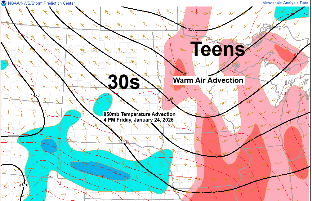
A warm front approaching from the west, combined with some weak lift and warm air advection, is producing a band of snow this afternoon over parts of northeast and east-central Minnesota. This area of snow shouldn’t last more than an hour or two as it continues to move toward the east.
Additional snow showers are expected later tonight and also on Saturday as a cold front moves across the Northland.
Snowfall anomalies for Duluth, Minnesota
Month to date: -3.2 inches below normal
Seasonal: -25.2 inches below normal
- 71% of days this month have been colder than normal in Duluth, with just 25% of days being warmer than normal.
- 3 days with a minimum temperature of -20°F or colder this month in Duluth. The normal amount in January is 3 days.

Radar loop ends 4:22 PM Friday, January 24, 2025.
Snowfall accumulations ranging from around 0.5 to 1.5 inches are expected across the Northland by Saturday afternoon, with some locally higher amounts of up to 2 inches possible, mainly in parts of far northern Minnesota and in the Arrowhead.
Duluth: An inch or less of snow tonight.
European model total snowfall through 6 PM Saturday.

NAM 3km model simulated radar forecast through 7 PM Saturday.

A windy weekend ahead as we see frequent airmass changes going from warm air advection to cold air advection and then back to warm air advection again.
Winds will become northwesterly on Saturday with gusts of 15 to 30 mph. On Sunday and Monday, winds will have a westerly component, with even stronger gusts possible that could approach 35 to 40 mph at times.
NAM model 850mb wind forecast valid 6 AM Sunday to 6 PM Monday.
Note: Those bright yellow and red colors on the loop indicate winds at 850 mb (~5,000 feet) of around 50 to 65 knots.


Subscribe to continue reading
Become a paid subscriber to get access to the rest of this post and other exclusive content.