6:52 PM Tuesday, February 11, 2025
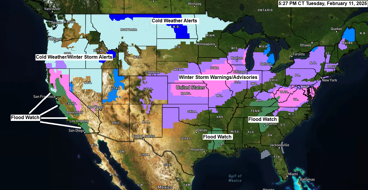
There are plenty of winter weather alerts currently in effect, ranging from cold weather alerts due to dangerously cold wind chills across the northern U.S. to winter storm warnings and advisories for heavy snow accumulations and/or significant ice accumulations stretching from the central Plains to the Midwest into parts of the Mid-Atlantic and Northeast U.S. We also have flood watches in effect in parts of the Southeast U.S., as well as parts of California.
- A Cold Weather Advisory is in effect from mid-evening until mid-morning Wednesday in much of northern Minnesota, with wind chills expected to be between 30 and 40 below zero.

Another frigid night ahead as we will see temperatures drop to between 15 below and 25 below zero in northeast Minnesota and northwest Wisconsin, with a few locations dropping to around 30 to 35 below zero once again. Note: Pretty similar temperatures are expected again for Wednesday night/Thursday morning.

HRRR model wind chill forecast through 11 AM Wednesday.

One snowy system will pass well to the south of the Northland on Wednesday, with accumulating snow likely over parts of southern Minnesota into central and southern Wisconsin.
HRRR model simulated radar forecast from 6 AM Wednesday to Midnight Wednesday night.

HRRR model total snowfall through late Wednesday night.

2 to 6 inches or more of snow are expected in the black outlined area on the map by late Wednesday night, according to the NWS forecast.

I’m reducing the yearly subscription price to my blog to $25 and the monthly price to $7. Thank you to all my current subscribers.

Subscribe to continue reading
Become a paid subscriber to get access to the rest of this post and other exclusive content.