6:33 PM Friday, February 28, 2025
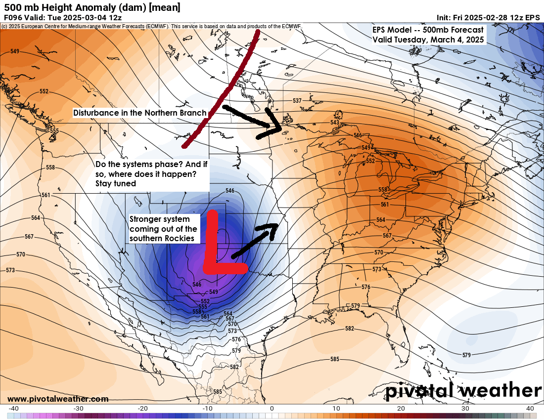
We’ve got a system for next week, and it looks to be a strong one, as is typical for March systems.
However, uncertainty remains regarding the storm track and the extent of phasing between the energy diving southeast from central Canada and the stronger low moving east-northeast from the southern Rockies.
The GFS is currently the most aggressive model, showing significant phasing that results in a substantial snow and wind event in Duluth late Tuesday to Wednesday. However, the GFS performed poorly with today’s clipper system and has a poor track record this winter, so its solution should be taken with caution.
Other computer models, including the UK, Canadian, and European, indicate some phasing occurring farther east, which would reduce the amount of precipitation (rain/snow) in most of the Northland next Tuesday and Wednesday.
Stay tuned.

A lot of wind across the Northland today, with peak wind gusts near 60 mph in Duluth and Brainerd.
Here’s a look at peak wind gusts from Friday, February 28, 2025.
Duluth, MN: 59 mph
Brainerd, MN: 57 mph
Duluth Sky Harbor Airport: 55 mph
Hibbing, MN: 52 mph
Ashland, WI: 51 mph
International Falls, MN: 42 mph
Local Storm Reports from February 28, 2025
- 11:18 AM: Non-Thunderstorm Wind Damage. Carlton, MN (Carlton County) Horse shed picked up by the wind, moved over a fence, and heavily damaged due to strong winds.
- 9:52 AM: Non-Thunderstorm Wind Damage. 1 S Cloquet, MN (Carlton County) Truck tipped over due to strong winds.
- 7:45 AM: Non-Thunderstorm Wind Damage. 2 W Duluth, MN (St. Louis County) Tree down over the road.
Snowfall Reports from February 28, 2025
3 NW Hovland, MN: 4.8″
4 NNE Grand Marais, MN: 4.5″
3 E Grand Marais, MN: 3.3″
Hovland, MN: 3.0″
4 W Grand Marais, MN: 2.4″
3 WSW Lutsen, MN: 1.1″
Snowfall Differences This Season
Sault Ste. Marie, MI has received 175.9 inches of snow this season, which is about 77 inches above normal as of February 28th.
Duluth, MN has had 40.7 inches of snow this season, which is about 27 inches below normal as of February 28th.
Here’s a look at today’s clipper system as it continues to exit off to the east this afternoon.
Low pressure of around 990 mb was over the northern portions of Lake Huron as of 6 PM on Friday.
Goes-16 infrared satellite loop ending 5:56 PM Friday, February 28, 2025.

Radar loop ends 6:04 PM CT Friday and a look at temperatures ending 6 PM CT Friday.
Here’s a look at the evolution of my snowfall forecast for today’s clipper system. Overall, a pretty good forecast in regard to where the highest snow totals were expected with today’s system.
Forecast issued Monday 2/24/2025

Wednesday’s forecast 2/26/2025

My final forecast issued for this event on Thursday 2/27/2025

Forecast track of today’s system ended up being a little farther north/east than what was forecast.


Thanks for reading!
Leave a Reply