8:00 PM Wednesday, April 23, 2025
Duluth had its warmest day of the year so far, reaching a high of 63 degrees today. The previous warmest was 62 degrees on March 10th and April 12th.
Temperatures rose almost 25 degrees from 41 to 64 in 20 minutes this afternoon at Duluth Sky Harbor Airport as northeast winds changed to the west.
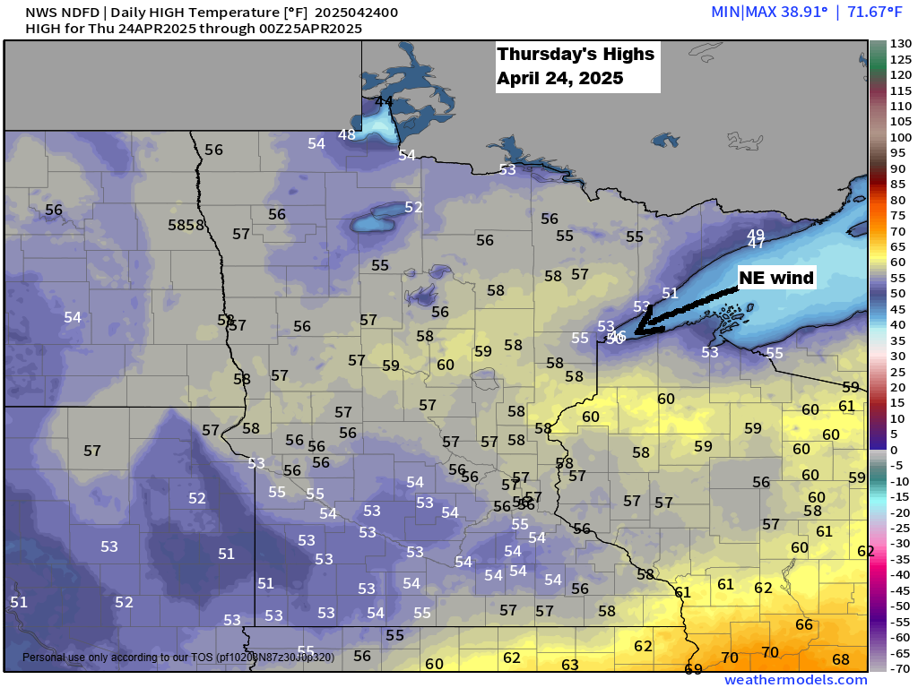
East wind returns Thursday, bringing cooler temperatures near the lake (about 40 to 43 degrees), while areas further inland will be in the 50s.
Since March 1st, there have been 26 days at the Duluth Airport with wind gusts of 30 mph or more, including today’s peak gust of 39 mph.
A system will move mostly south of the Northland from Thursday afternoon to early Friday morning, bringing significant rain to parts of southern Minnesota and central Wisconsin. Some scattered rain may reach eastern Minnesota and northwest Wisconsin, but these areas will see less rainfall, mainly occurring late Thursday afternoon into early Friday morning.

Note: The Euro model shows rain mainly south of eastern Minnesota and northwest Wisconsin from Thursday afternoon to early Friday morning, so some uncertainty does exist in the computer models regarding how far north the rain reaches later in the day Thursday.
Euro model simulated radar forecast valid 7 AM Thursday to 7 AM Friday.

A large region faces the risk of severe thunderstorms next Monday, April 28th, (indicated by the yellow area on the map). The risk area has expanded further to the north and east compared to yesterday, and additional updates to the risk area are likely in the coming days.
Whether or not this severe risk includes tornadoes or is more of a hail and wind threat is uncertain right now, as that will depend on many factors. For now, this is just a heads up that we could see some severe thunderstorms over a large area from the central Plains to the upper Midwest early next week.

A strong low-pressure system is expected to move east-northeast from the northern Plains next Monday, bringing its warm and cold fronts with it. Southerly winds will push warm, humid and unstable air into parts of the upper Midwest early next week. This, along with strong winds in the atmosphere, will make conditions favorable for potential strong thunderstorms early next week.

A vigorous mid- and upper-level trough is also forecast to lift northeast out of the Rockies and northern Plains early next week, which will increase the amount of lift in the atmosphere.

Thanks for reading!
Leave a Reply