6:16 PM Thursday, May 8, 2025
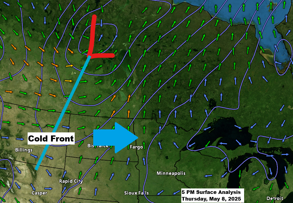
A cold front over the northern Rockies this afternoon is expected to move eastward and traverse the Northland by Friday afternoon and evening. Moisture ahead of this front will be limited, with dew points only reaching the 40s on Friday afternoon. The lift associated with the front does not appear particularly strong. Consequently, this combination is likely to result in only a few showers and possibly thunderstorm in parts of the Northland on Friday and into Friday evening, though it is anticipated that most areas will remain dry.
Temperatures will rise before the front on Friday, with southwest winds bringing warmth into the 70s and low 80s, even near Lake Superior.
It was cold in Hibbing this morning, with a low of 24 degrees, just 3 degrees above the record low of 21 degrees for May 8th, set in 1983.
It will be another cold night with temperatures dropping to the 30s and some places in the 20s.
HRRR model simulated radar forecast valid 7 AM Friday to Midnight Saturday.

A few thunderstorms may occur late Friday afternoon, especially in central and eastern Minnesota, according to the Euro model.

A warm pattern is expected to develop on Sunday and last until mid-next week. Temperatures in the 70s and 80s are likely in the Northland from Sunday to Wednesday, with a chance of hitting 90 degrees in a few locations.
Around the middle of next week, an upper low/trough along with its warm and cold fronts is expected to impact the Northland. This system may bring showers or thunderstorms to the region Wednesday or Thursday.

Precipitation anomalies for May 2025 as of 4 PM on the 8th
Ashland, WI: -0.52″ below normal
Brainerd, MN: -0.43″ below normal
International Falls, MN: -0.20″ below normal
Hibbing, MN: -0.06″ below normal
Duluth, MN: +0.01″ above normal
Thanks for reading!
Leave a Reply