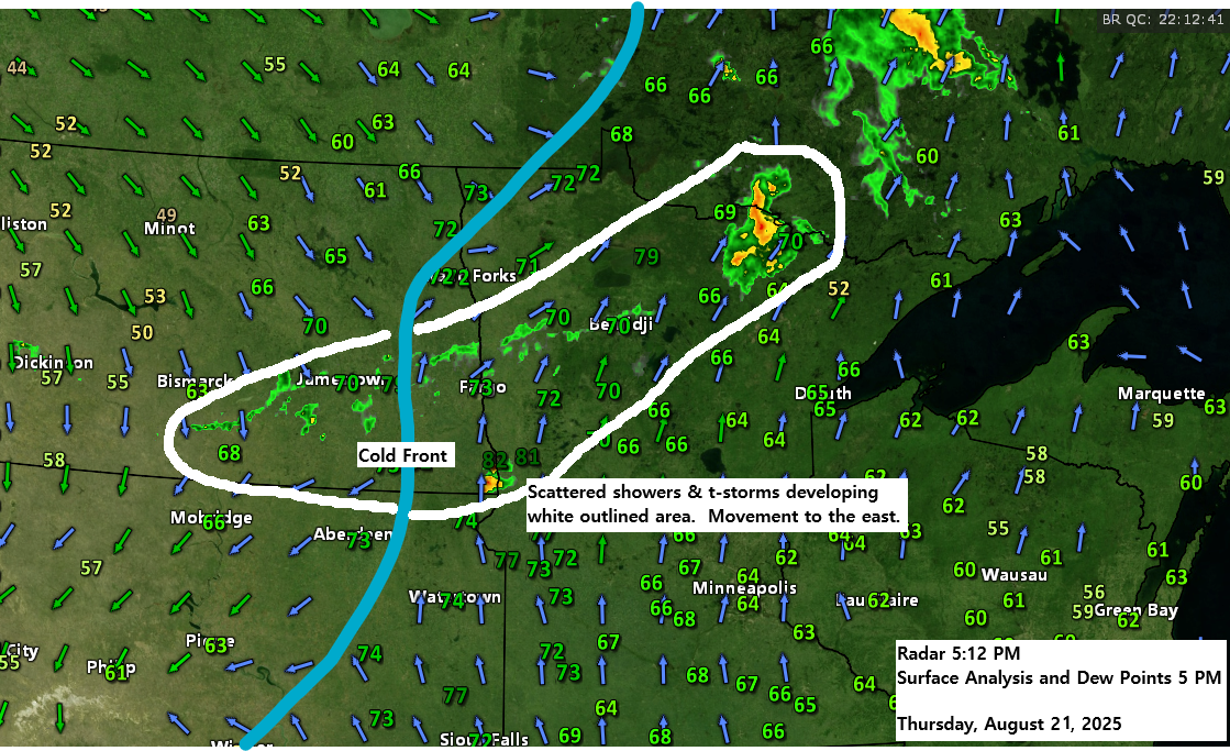
A cold front is expected to move across the Northland tonight and into Friday. It should clear northeast Minnesota by noon on Friday and exit northwest Wisconsin by Friday evening.
Scattered showers and thunderstorms are expected as the front moves through tonight into early Friday morning. Additional showers and storms may develop Friday afternoon, mainly in parts of northwest Wisconsin, while isolated showers could pop up again across northern Minnesota.
Computer models have trended cooler this weekend with Sunday looking like the coolest day of the weekend.
Rainfall amounts between 0.1 and 0.25 inches are possible across most of northeast Minnesota and northwest Wisconsin by late Friday afternoon, with areas in northern Minnesota, from Bigfork to International Falls, potentially seeing over 0.5 inches of rain.

On Friday, two weather systems, marked in blue and red on the map, will be in play. The northern system in blue may bring a few showers to northern Minnesota by Friday afternoon and evening. Meanwhile, the southern system in red could generate a more organized area of showers and thunderstorms during the day, primarily impacting southern, central, and eastern Minnesota, as well as parts of western, central, and northern Wisconsin.


Subscribe to continue reading
Become a paid subscriber to get access to the rest of this post and other exclusive content.