A few showers will pass through the Northland this evening, followed by partial clearing overnight, creating a chance for patchy frost in areas of northeast Minnesota and northwest Wisconsin away from Lake Superior. Temperatures tonight will drop into the 30s and 40s, with the warmest spots near Lake Superior.
The threat of patchy frost early Thursday morning in Duluth is greatest on top of the hill, with no frost expected in lower elevation areas below the hill closer to Lake Superior.
The average date of the first 32-degree temperature.
- Hibbing, MN: September 15 (earliest date, August 13 in 2004)
- International Falls, MN: September 15 (earliest date, August 20 in 1907)
- Ashland, WI: September 18 (earliest date, August 18 in 1950)
- Brainerd, MN: September 22 (earliest date, August 6 in 1977)
- Duluth, MN: October 1 (earliest date, August 27 in 1986)
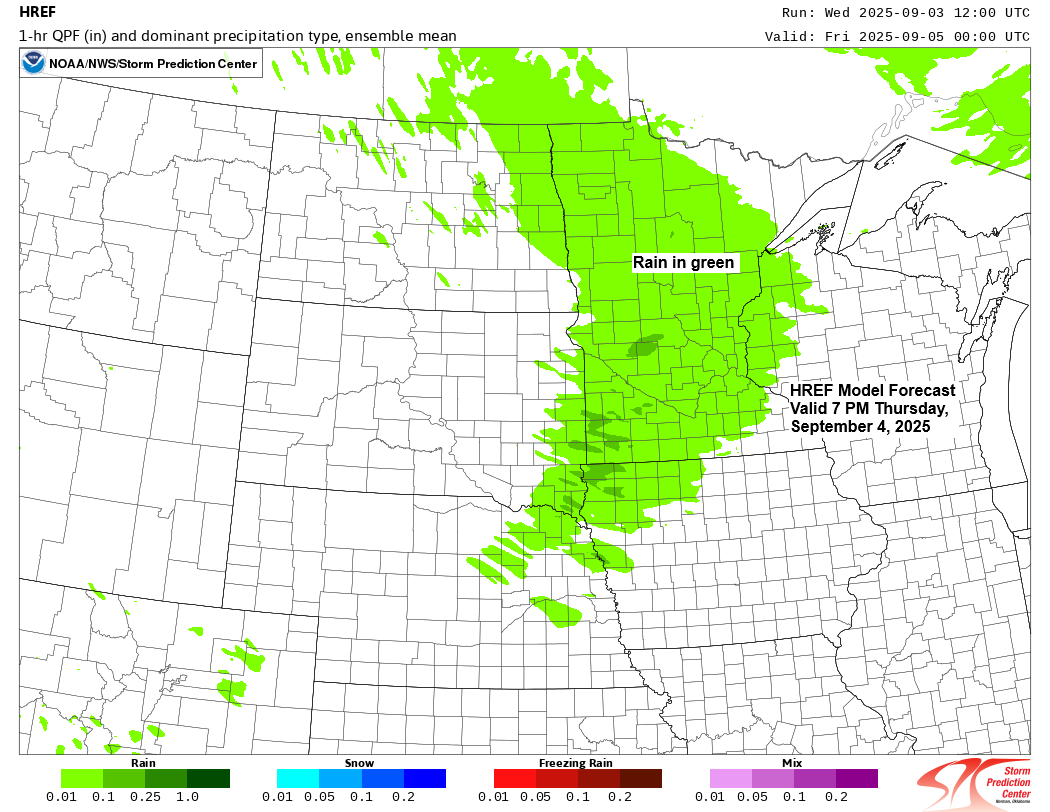
A clipper system will sweep through the upper Midwest from Thursday afternoon to early Friday morning, bringing more rain to parts of the Northland. Afterward, there will be chances for a few isolated showers on Friday and Saturday.
Note: Rain is expected to start in Duluth late Thursday afternoon between 5 and 7 PM, gradually tapering off after midnight or early Friday morning.
NAM 3km model simulated radar forecast valid 7 AM Thursday to 7 AM Friday.

Here are some computer model forecasts for rainfall totals for the Thursday afternoon to 7 AM Friday time frame.
The NAM 3km and HRRR models predict higher rainfall in Duluth, with amounts reaching up to half an inch, whereas the EURO and AI models suggest slightly less rain, with totals closer to a quarter of an inch.


The 500mb heights are continuing to drop today as a cool air mass settles into the Northland.
At 4 PM today, 500mb heights across the Northland ranged from 547 meters in Grand Marais, MN, to 550 meters in Duluth, and 556 meters in Brainerd. These heights are about -3 to -4 sigma below the average for early September.
850mb temperatures have fallen to about 0°C in far northeast Minnesota today, with values ranging from +1°C to +2°C across the rest of the Northland.
Temperatures in northeast Minnesota and northwest Wisconsin ranged from the upper 40s to the low and mid-50s today, significantly cooler than the usual early September highs, which are typically in the low to mid-70s.


Subscribe to continue reading
Become a paid subscriber to get access to the rest of this post and other exclusive content.