Dense fog is moving in again tonight, spreading west and south from Lake Superior. It will linger into Thursday morning before clearing by the afternoon, with another round expected to roll in Thursday night.
Note: Inland areas are likely to see the fog clear more quickly on Thursday, while locations within 10 to 20 miles of Lake Superior may experience a slower dissipation of fog and low clouds into the afternoon.

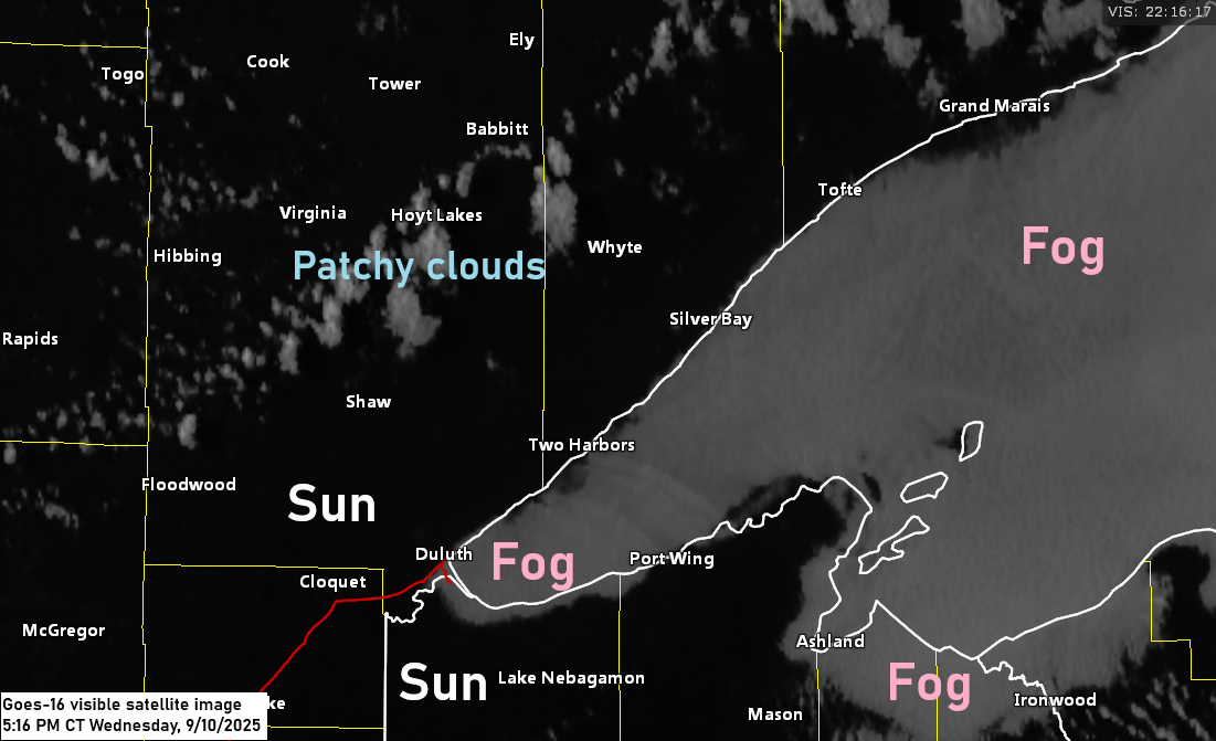
Visibility has already dropped to about a quarter mile due to dense fog at Duluth Sky Harbor Airport this afternoon. However, in other parts of the area, visibility remains around 10 miles for now. Expect these conditions to deteriorate further as the night progresses.

Fog and low clouds have been prevalent over Lake Superior today, and they are expected to spread farther inland from the lake tonight.
GOES-16 visible satellite loop concluding at 4:51 PM CT on Wednesday, September 10, 2025.

The pattern continues to become more amplified today, and this trend will continue for the rest of the week and into the weekend. The Northland will be in the quiet part of this pattern as an upper-level ridge controls our weather, but there could be some rain in parts of the area on Friday due to a warm front that is forecast to be well south of our area.

The NAM 3km model and the HRRR model indicate some rain and possibly a few thunderstorms over northern Minnesota around midmorning on Friday. While there are signals suggesting rain on Friday, the extent to which it will spread south and east remains uncertain at this time.


By early next week, there are indications that the weather pattern might shift slightly as a trough attempts to move northeast into the upper Midwest. However, it will encounter a ridge, so it’s uncertain how much rain the Northland will receive from this approaching trough.

Leave a Reply