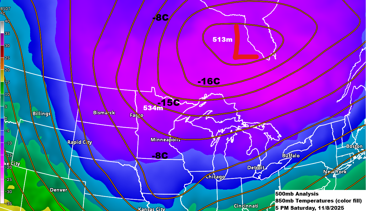
A surge of cold air will continue to flow into northeast Minnesota and northwest Wisconsin through Monday, with the coldest conditions settling over the area on Sunday before shifting to the south and east. Temperatures at 850mb will drop to about -16°C, while 500mb heights will range between 525 and 532 meters.
The coldest air within this upper low, a segment of the polar vortex, will move east of our region, heading south from eastern Ontario through the central and eastern Great Lakes by Monday morning. Temperatures near the center of this upper low will range between -38°C and -41°C at 500mb, roughly 18,000 feet above the ground.
RAP model 500mb temperature forecast through 6 AM Monday.

Scattered snow showers and flurries will persist across northeast Minnesota and northwest Wisconsin tonight and Sunday. Most areas will only see a light dusting of accumulation, but there are exceptions. Lake effect snow is expected along the South Shore of Lake Superior, from Ashland east to the Hurley and Gile areas, through early Monday morning. Other areas near larger inland lakes in northern Minnesota may also see a few inches of snow accumulation, which is common when early-season cold air masses move over warmer lakes.
Radar loop ends 5:54 PM Saturday, November 8, 2025.
Winter storm warnings and advisories are active for lake-effect snow until early Monday morning along the South Shore of Lake Superior, covering areas from northern Wisconsin to upper Michigan.

Here’s a look at the HRRR model’s snow totals through noon on Monday, using a standard 10:1 ratio.

Across northern Minnesota, most areas are expected to see an inch or less of snow through early Monday morning. However, heavier lake-effect snow showers from Lake of the Woods could result in snow totals of 2 to 6 inches near and south of Baudette.

It was a chilly morning in the Northland, with temperatures plunging into the teens and 20s. Some of the lowest readings were in Hibbing, Cook, and Ely, all hitting a frosty 10 degrees.
Typical low temperatures in northeast Minnesota and northwest Wisconsin during this time of year range from the low to upper 20s.
This morning, the official low temperature in Duluth, recorded at the airport, was 18 degrees. The last time Duluth saw a temperature of 18 degrees or lower was on April 8, 2025, when it hit 14 degrees.

This afternoon, temperatures in northeast Minnesota and northwest Wisconsin only climbed to the mid-20s and low 30s. Typically, highs this time of year range from the upper 30s to the low-to-mid 40s.
The high temperatures on Sunday and Monday are expected to be similar to today’s.

Leave a Reply