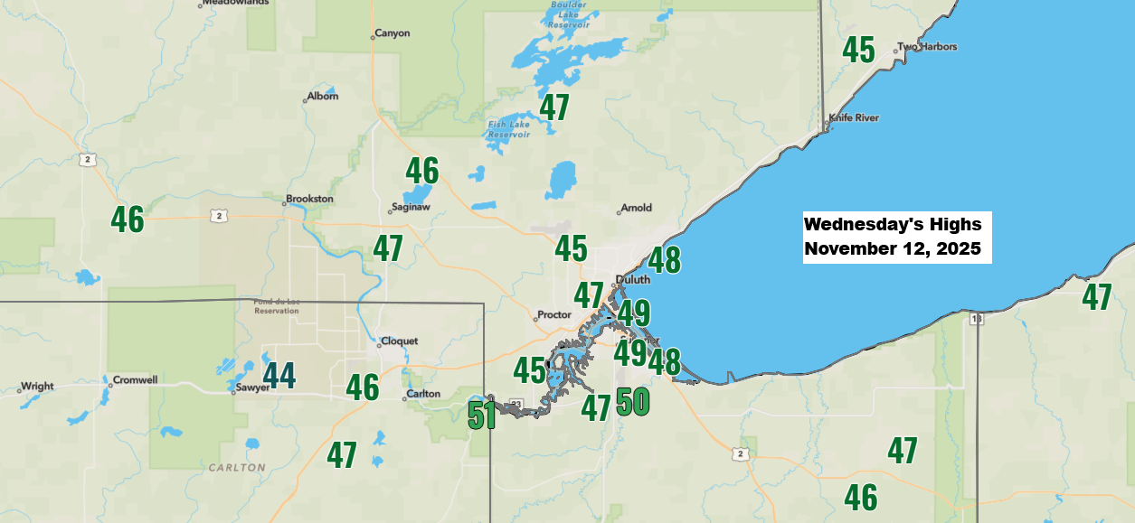
A milder weather pattern has settled in, with much of the Northland reaching highs in the 40s today and a few spots even hitting 50 degrees. That’s about 5 to 8 degrees warmer than average, so nothing too out of the ordinary.
Highs on Thursday will reach the 40s again, and Friday will likely bring temperatures in the 40s to 50s before cooler air moves in over the weekend, though nothing arctic.

Over the next week, Duluth is expected to see little to no snowfall, with none of the 20 GEFS ensemble members predicting significant snow through next Wednesday, November 19th.
As of November 12th, Duluth has seen 4.2 inches less snowfall than normal for the month, and 7.0 inches below average since October 1st.
The snowfall in Duluth is starting off much like last winter, but with the snow season still in its early days, there’s plenty of time for things to change.

This Friday night, a cold front will sweep across the Northland as a low-pressure system (marked in red) moves well north of our region. Little to no precipitation is expected as it passes through.
Another system, marked in dark red, is set to move into the southwest U.S. on Saturday and is expected to lift northeast early next week. However, it looks like most of the precipitation from this system will pass south of the Northland.
Long-range models are hinting at a potential system that could impact the Northland around November 21-23, bringing possible rain or snow. But with it being over 200 hours away, I’m not giving it much weight just yet.

Leave a Reply