It’s been a snowy evening across parts of the Northland, especially along the North Shore of Lake Superior and over the Bayfield Peninsula in northwest Wisconsin.
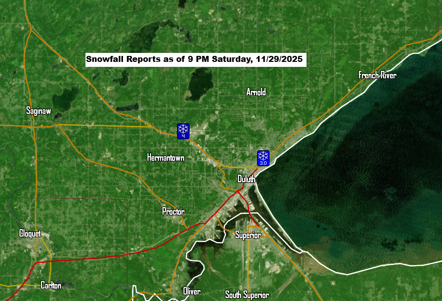
In Duluth, reports show between 3 and nearly 5 inches of snow since late this afternoon, with the National Weather Service recording an official total of 4.9 inches by 9 PM. Snowfall rates have been over an inch per hour since 6 PM.
There’s also been reports of around 3 to 4 inches of snow in both Wrenshall and Two Harbors this evening.
A surface low is sliding well to our south tonight, with low pressure over eastern Iowa tracking east-northeast. North of it, surface winds have been out of the north-northeast, while higher up they’ve come from the east to northeast. With plenty of cold air (-12 to -14°C at 850mb) flowing over the milder 40+°F waters of Lake Superior, a steady band of fluffy lake-effect snow has set up along the North Shore this afternoon and evening. A convergence zone along the shore has added an extra boost to the snowfall.
The favorable conditions for lake effect snow in Duluth and farther up the North Shore will gradually fade from north to south through late tonight, with most of the snow shifting to the South Shore of Lake Superior in northwest Wisconsin, east of the Twin Ports, overnight.

Make a one-time donation
Make a monthly donation
Make a yearly donation
Choose an amount
Or enter a custom amount
Your contribution is appreciated.
Your contribution is appreciated.
Your contribution is appreciated.
Looks like the snow will taper off in Duluth early Sunday morning between about 2 and 4 AM, but until then, we could get another 1 to 3 inches of fluffy snowfall in parts of Duluth and Superior.
As of 9 PM, the snow band along the North Shore is showing signs of finally shifting southward, but it will still take a few more hours for it to move out of Duluth.
Radar loop ends 9:38 PM Saturday, November 29, 2025.
Leave a Reply