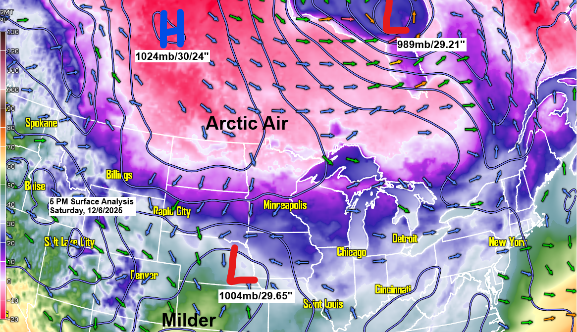
It’s already chilly, but temperatures will drop even further tonight through Monday morning as arctic high pressure moves southeast from Saskatchewan.
Tonight, lows in northeast Minnesota and northwest Wisconsin will range from about 5°F above to 20°F below zero. On Sunday, daytime highs will only reach around zero to 7°F, with Sunday night dropping again to about -5°F to -20°F.
It’ll warm up a bit on Monday and Tuesday, but with the milder temps comes the chance for accumulating snow from two separate clipper systems. The stronger one is expected on Tuesday, though there’s still some uncertainty in the models about the low’s track, which will determine how much snow falls in the Northland.
Monday’s clipper is expected to bring 1 to 2 inches of snow across much of northern Minnesota and northwest Wisconsin, with most of it falling Monday evening before tapering off overnight. Some areas may also see a quick burst of snow Monday morning, with less than an inch of accumulation.
NAM-Nest simulated radar forecast valid from Midnight Monday to Midnight Tuesday.

Computer models show different tracks for Tuesday’s low. Some predict it will move farther south toward the Minnesota-Iowa border, which would lower the chances of accumulating snow in much of the Northland. Others track it farther north, keeping the potential for several inches of snow in the forecast for much of northeast Minnesota and northwest Wisconsin. Stay tuned.
The clipper on Tuesday appears strong, with a significant temperature difference from the 10s in northern Minnesota to about 40 in the southwest part of the state.

There’s also a sharp thermal gradient in the 850mb temps on Tuesday, ranging from about +8°C in far southwest Minnesota to -5°C in northern Minnesota, and down to -18°C in central Manitoba.

The MJO (Madden-Julian Oscillation) is currently in phase 8, which often brings colder, stormier, and snowier conditions to northeast Minnesota and northwest Wisconsin. Phase 8 can sometimes deliver some of the most extreme blasts of arctic air, so it will be interesting to see how things develop in the coming weeks. There’s also a chance the MJO could slip into the “circle of death” around mid-month before possibly returning to phase 8. The circle of death simply means the MJO is weak or inactive, often signaling a transition period, so that’s something to watch as well.

As expected, today’s clipper stayed well south of the Northland, dropping several inches of snow across parts of the Dakotas, far southern Minnesota, and Iowa. Around Sioux Falls, SD, and near and west of Bismarck, ND, reports came in of about 7 inches, while most other areas saw between 1 and 4 inches.
Radar loop ends 5:54 PM Saturday, December 6, 2025.
Make a one-time donation
Make a monthly donation
Make a yearly donation
Choose an amount
Or enter a custom amount
Your contribution is appreciated.
Your contribution is appreciated.
Your contribution is appreciated.
Leave a Reply