It’s going to be very cold tonight across the Northland, with lows dipping from about 5 below to as much as 20 below zero, and Sunday will stay chilly with highs only in the teens.
Strong winds blew through today as another surge of arctic air moved into the Northland, with peak gusts reaching 47 mph at both the Duluth Airport and in Ashland, WI.

Late Sunday night, east central Minnesota and northwest Wisconsin could see a burst of snow or a wintry mix, with less than an inch of snow accumulation expected.
Another round of snow or a wintry mix could hit northern Minnesota late Monday into Monday night.
NAM-Nest simulated radar forecast valid 7 PM Sunday to Midnight Tuesday.
Snow – blue
Wintry mix – purple

Heads up: There’s a chance of some wintry precipitation (snow or a mix) around Christmas Day, but it doesn’t look like a major system right now.
Duluth has seen nearly 6 inches of snow so far this month (5.9 inches), which is 6.2 inches below normal. Last December, we had more snow—6.6 inches—than what we’ve gotten so far this December through the 20th.
Snowfall Reports for December 20-21, 2025
Grand Marais, MN: 1.8″
International Falls, MN: 1.3″
Duxbury, MN: 1.1″
Butternut, WI: 1.0″
Hinckley, MN: 1.0″
Moquah, WI: 1.0″
Cornucopia, WI: 1.0″
Ashland, WI: 1.0″
Iron Junction, MN: 0.6″
Hayward, WI: 0.5″
Two Harbors, MN: 0.4″
Duluth, MN: 0.3″ (official total at the NWS)
No surprise that Duluth has had many more colder-than-average days this month compared to warmer ones, and I expect that trend will stick around for the rest of the month.
Yes, there’s no doubt we’ll see a few brief warm-ups over the next week or so, but bursts of colder air will likely stick around too.

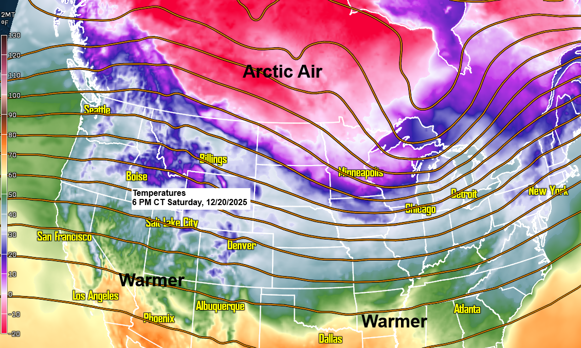
This month has seen a steady northwest flow aloft, bringing cooler-than-average temperatures east of the Rockies, while the western U.S. has experienced warmer-than-average conditions.
As of the 19th, the average monthly temperature in Duluth for December 2025 is a staggering 10.2 degrees below normal.

With the widespread arctic air lingering to our north and northwest, I just don’t see any long-lasting thaws happening in northeast Minnesota or northwest Wisconsin. We’d need a significant shift in the pattern for that to occur, and I’m not seeing anything like that in the models. In fact, it looks like the pattern could turn even colder as we head into early January.

Leave a Reply