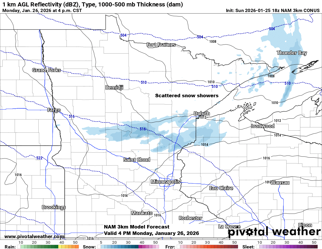
A bit of snow is expected Monday afternoon into early evening as a fast-moving clipper sweeps through the area. With minimal moisture and limited lift, any snowfall will likely be light, no more than a trace to about half an inch of accumulation.
The only real chance for a bit of snow this week is on Monday; otherwise, it seems we’ll be waiting until sometime next weekend for another shot at a light snowfall. The current pattern just doesn’t support any major snow events in our area anytime soon.
NAM 3km model simulated radar forecast valid 12 PM to 10 PM Monday.

This past week has been colder than normal, with a stubborn Arctic air mass hanging over the area.
From January 18 to 24, 2026, Duluth’s average temperature was -9.4 degrees, about 20 degrees colder than normal.
Areas shaded in purple on the map indicate average temperatures about 10 to 15 degrees or more below normal from January 18 to 24, 2026.

This afternoon, temperatures in the Twin Ports, parts of northwest Wisconsin, and east central Minnesota rose to around zero or even a few degrees above, marking some of the warmest readings in days. Meanwhile, northern Minnesota still saw subzero temperatures throughout the afternoon.
Across the Northland, nighttime and morning temperatures will remain well below zero—anywhere from the teens to 30s below—through at least Friday. Afternoons, however, should see a slight warm-up to around 3 below to just a few degrees above zero.
Note: We probably won’t get a break from the subzero nighttime temperatures until next weekend.

It was another bitterly cold morning across northeast Minnesota and northwest Wisconsin, with temperatures plunging into the -20s and -30s in many spots.
Here are some of the chilliest readings from Sunday morning.
- Seagull Lake, MN: -40
- Indus, MN: -39
- Orr, MN: -38
- Brimson, MN: -36
- Ely, MN: -36
- Cook, MN: -36
- Embarrass, MN: -35
On Sunday morning, Duluth recorded an official low of -17 degrees, matching the temperature at Duluth Sky Harbor Airport, while Superior dipped even colder to -21 degrees.

Cold weather alerts are in effect through noon Monday, with wind chills plummeting to -45 degrees in areas under the extreme cold warning and ranging from -35 to -40 degrees in regions under the cold weather advisory.

Leave a Reply