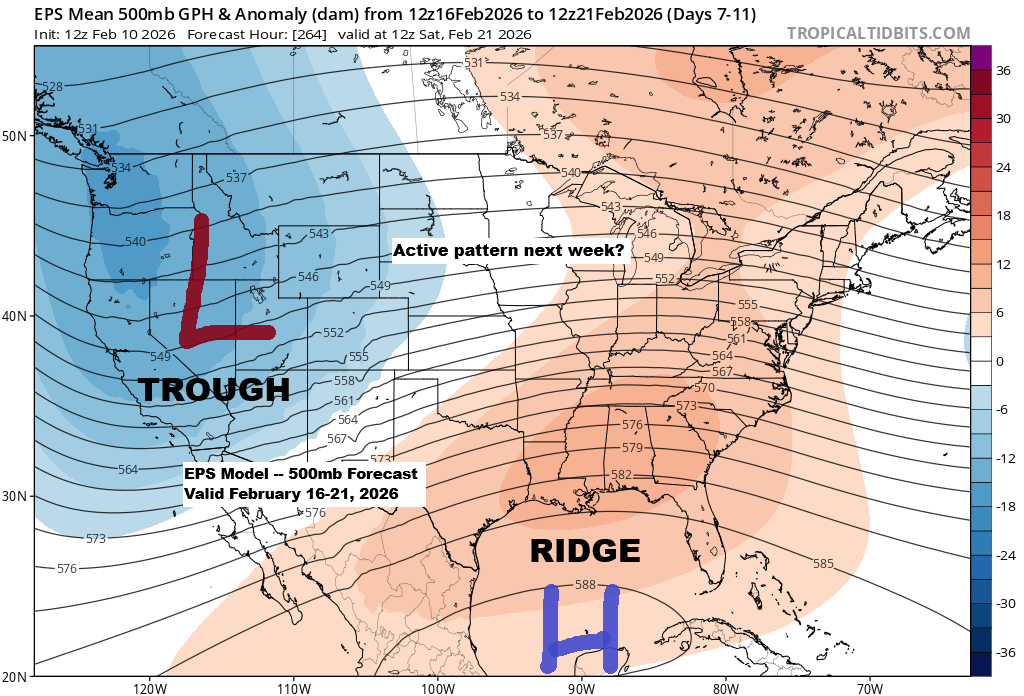
It looks like there’s potential for an active weather pattern to develop across the upper Midwest next week, especially from the middle to the end of the week based on current trends.
A general pattern of troughing in the West and a ridge over the Southeast U.S. appears to be setting up, which could bring a southwest flow aloft across the Plains. Combined with energy moving northeast from that western trough, this may result in a couple of systems tracking toward the upper Midwest next week.
The storm track, timing, and intensity are still highly uncertain, as are the types of precipitation that could occur in northeast Minnesota and northwest Wisconsin, with models shifting daily. Right now, anything is possible—rain, a wintry mix, all snow, or even mostly dry conditions—depending on whether these systems take an unfavorable or, depending on perspective, favorable path.
All three ensemble models are showing precipitation totals of at least half an inch next week in northeast Minnesota and northwest Wisconsin, so if most of that comes down as snow, we could be in for some pretty hefty amounts.


…Short Term…
Not much happening with the weather around here the rest of this week into this weekend. Cooler conditions returned today, with the day’s highs actually recorded early this morning before sunrise, in the mid-20s to mid-30s. Later, gusty northwest winds, hitting nearly 40 mph in Duluth, swept in cooler air for the afternoon.
Tonight’s lows in the Northland will dip into the single digits and teens, with Wednesday’s highs reaching the 20s to low 30s. Warmer temperatures will move in for the rest of the week and into the weekend, bringing highs in the 30s and 40s.
Leave a Reply