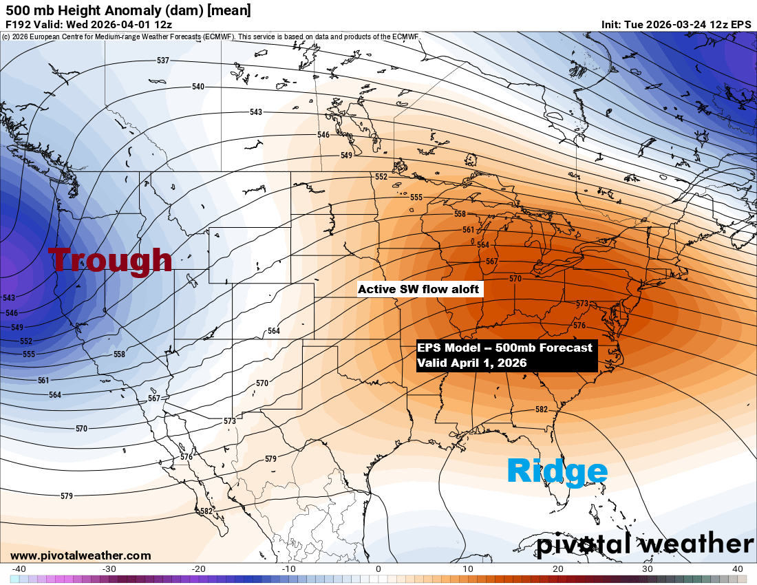
Next week’s weather could turn more active, with a trough developing over the western U.S., sending southwest winds aloft across the Plains and creating ridging in the southeast. This setup might mean a busy period for the upper Midwest, including the Northland, as a few systems could track northeast from the Rockies and Plains. While it’s too soon to know exactly how strong they’ll be or where they’ll go, they could bring snow, rain, a wintry mix, and possibly some thunderstorms from mid to late week.
The EPS, GEFS, and CMCE ensemble models are predicting more than an inch of precipitation for northeast Minnesota and northwest Wisconsin through April 8, 2026.


Before next week arrives, we have two systems to contend with through Thursday, but neither seems particularly impressive in terms of the precipitation they’ll bring to northeast Minnesota and northwest Wisconsin.
Late tonight into early Wednesday, a system could bring some rain or a wintry mix to far northern Minnesota and the Arrowhead region north of Duluth. Then, late Wednesday night into early Thursday, another system may deliver another round of rain or a wintry mix to parts of the Northland.
Late Wednesday night’s system looks like it could pack some stronger lift (outlined in black), so it’s worth keeping an eye on to see if that trend holds over the next 24 hours.

NAM 3km model simulated radar forecast valid Midnight tonight to 12 PM Thursday.

Almost the entire U.S. has experienced temperatures well above average this month, with the darker brown and pink areas showing averages running 7 to 10 degrees or more above normal through March 23rd.
The only notably cool area has been from northeast North Dakota to northern Minnesota, where this month’s average temperatures range from 3 degrees below to 3 degrees above normal.
Temperature anomalies in the Northland for March 2026 through the 23rd.
- Hibbing, MN: +4.2 degrees above normal
- Ashland, WI: +2.9 degrees above normal
- Brainerd, MN: +2.4 degrees above normal
- Duluth, MN: +1.5 degrees above normal
- International Falls, MN: +0.7 degrees above normal

This month, precipitation has been about a quarter inch above normal in Duluth and nearly a quarter inch below normal in International Falls.
Duluth: +0.29 inches above normal
International Falls: -0.19 inches below normal
Note: Although far from us, I have to mention the extreme weather hitting Hawaii this month, as several powerful Kona Lows have caused significant flooding.
As of March 23rd, Honolulu, HI has received 13.53 inches of rain this month, compared to its average annual precipitation of 19.15 inches.
Total precipitation anomaly for March 2026 through the 23rd.
Green and blue areas: Above Normal
Yellow, brown and red areas: Below Normal

Leave a Reply