A cool northwest flow aloft has settled over the upper Midwest, thanks in part to an upper-level low in central Canada that’s drawing down some late-season chilly air.
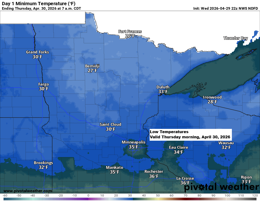
Temperatures tonight, Thursday night, and Friday night will drop into the 20s to low 30s across northeast Minnesota and northwest Wisconsin. For comparison, typical lows around this time of year are usually in the 30s.
This afternoon, temperatures at 850mb (around 5,000 feet) range from about -4 to -6°C in northeast Minnesota and northwest Wisconsin, which is pretty chilly for late April.
The next few days will stay cool, with a brief warm-up expected this weekend when afternoon temperatures could reach around 60 or the low 60s, before another round of chilly air moves in next week.


The weather pattern has become more amplified, meaning changes will be slower moving forward. It’s likely we won’t see any sustained, significant warmups in our area through the first half of May, and the chances of additional widespread rain events like those recently are much lower, at least for the first and second weeks of May.
Goes-19 water vapor loop ending 5:10 PM CT Wednesday, April 29, 2026.

Scattered showers have been drifting southeast through the area today, with a few reports of snow mixed in and temperatures hovering in the mid-30s to around 40 degrees.
Note: The Duluth Airport reported a little snow this afternoon.
Radar loop ends 5:04 PM CT Wednesday, April 29, 2026.
A few light showers of snow or rain will linger over the Northland tonight and into Thursday, but little to no accumulation is expected.
HRRR model simulated radar forecast through 7 PM Thursday.

Leave a Reply